
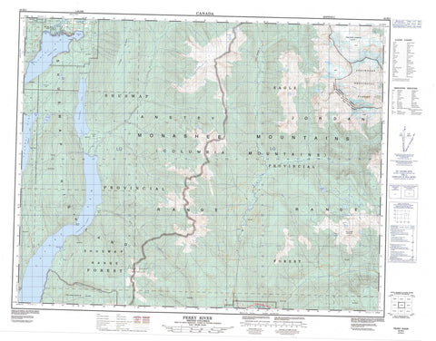
082M02 Perry River Canada topo map, 1:50,000 scale
082M02 Perry River NRCAN topographic map.
Includes UTM and GPS geographic coordinates (latitude and longitude). This 50k scale map is suitable for hiking, camping, and exploring, or you could frame it as a wall map.
Printed on-demand using high resolution, on heavy weight and acid free paper, or as an upgrade on a variety of synthetic materials.
Topos available on paper, Waterproof, Poly, or Tyvek. Usually shipping rolled, unless combined with other folded maps in one order.
- Product Number: NRCAN-082M02
- Parent Topo: TOPO-082M
- Map ID also known as: 082M02, 82M2, 82M02
- Unfolded Size: Approximately 26" high by 36" wide
- Weight (paper map): ca. 55 grams
- Map Type: POD NRCAN Topographic Map
- Map Scale: 1:50,000
- Geographical region: British Columbia, Canada
Neighboring Maps:
All neighboring Canadian topo maps are available for sale online at 1:50,000 scale.
Purchase the smaller scale map covering this area: Topo-082M
Spatial coverage:
Topo map sheet 082M02 Perry River covers the following places:
- Anstey Arm - Beach Bay - Bughouse Bay - Dasniers Bay - Pete Martin Bay - Seymour Arm - Steamboat Bay - Twin Bays - Broken Point - Fowler Point - Black Lake - Cranberry Lake - Hidden Lake - Hunakwa Lake - Shuswap Lake - Twin Lakes - Wright Lake - Anstey Range - Columbia Mountains - Eagle Pass Mountain - Jordan Range - Long Ridge - Monashee Mountains - North Queest Mountain - Shuswap Highland - Shuswap Range - Columbia-Shuswap Regional District - Cinnemousun Narrows Park - Shuswap Lake Marine Park - Silver Beach Park - Interior Plateau - Anstey River - Bass Creek - Bews Creek - Crazy Creek - Eagle River - Four Mile Creek - Frisby Creek - Hunakwa Creek - Jordan River - Perry River - Pete Creek - Queest Creek - Rocky Creek - Seymour River - West Gorge Creek - Seymour Arm - Clinton


