
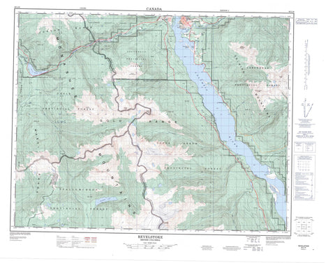
082L16 Revelstoke Canada topo map, 1:50,000 scale
082L16 Revelstoke NRCAN topographic map.
Includes UTM and GPS geographic coordinates (latitude and longitude). This 50k scale map is suitable for hiking, camping, and exploring, or you could frame it as a wall map.
Printed on-demand using high resolution, on heavy weight and acid free paper, or as an upgrade on a variety of synthetic materials.
Topos available on paper, Waterproof, Poly, or Tyvek. Usually shipping rolled, unless combined with other folded maps in one order.
- Product Number: NRCAN-082L16
- Parent Topo: TOPO-082L
- Map ID also known as: 082L16, 82L16
- Unfolded Size: Approximately 26" high by 36" wide
- Weight (paper map): ca. 55 grams
- Map Type: POD NRCAN Topographic Map
- Map Scale: 1:50,000
- Geographical region: British Columbia, Canada
Neighboring Maps:
All neighboring Canadian topo maps are available for sale online at 1:50,000 scale.
Purchase the smaller scale map covering this area: Topo-082L
Spatial coverage:
Topo map sheet 082L16 Revelstoke covers the following places:
- Revelstoke - The Salmon Rocks - Frog Falls - Sutherland Falls - Beach Island - Cable Island - Illecillewaet Island - Melbourne Island - Arnica Lake - Balsam Lake - Begbie Lake - Brim Lake - Clanwilliam Lake - Col Lake - Echo Lake - English Lake - Green Lake - Greenbush Lake - Griffin Lake - Heart Lake - Joss Lake - Montana Lake - Montana Slough - Revelation Lake - Scottish Lake - Surprise Lake - Three Valley Lake - Tilley Lake - Topowap Lake - Turquoise Lake - Two Moon Lake - Upper Arrow Lake - Victor Lake - Wetask Lake - Williamson Lake - Anemone Ridge - Big Bend Ranges - Blanket Mountain - Columbia Mountains - Columbia System - Davis Peak - Garnet Ridge - Ghost Peak - Ghost Rock - Gold Range - Hunters Range - Jordan Range - Joss Mountain - Mabel Range - Monashee Mountains - Mount Begbie - Mount Cartier - Mount English - Mount Mackenzie - Mount Macpherson - Mount Tilley - Sawtooth Range - Selkirk Mountains - Columbia-Shuswap Regional District - Blanket Creek Park - Blanket Creek Recreation Area - Columbia Village Historic Park - Victor Lake Park - Powder Springs - Akolkolex River - Begbie Creek - Blanket Creek - Bowman Creek - Bridge Creek - Columbia River - Cranberry Creek - Derry Creek - Dolan Creek - Drimmie Creek - Eagle River - Fleuve Columbia - Frog Creek - Gagney Creek - Greeley Creek - Greely Creek - Greenslide Creek - Griffith Creek - Illecillewaet River - Locks Creek - Montana Creek - Mulvehill Creek - Rutherford Creek - Scott Creek - Shuswap River - South Cranberry Creek - South Pass Creek - Tonkawatla Creek - Tonkawatla River - Victor Creek - Wap Creek - Wells Creek - Big Eddy - Clanwilliam - Greenslide - Mount Cartier - Three Valley - Wigwam - Box Canyon - Eagle Pass - Hellebore Pass - Joss Pass


