
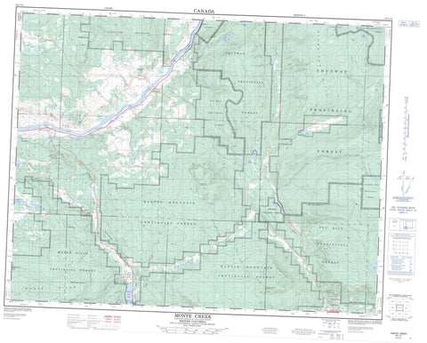
082L12 Monte Creek Canada topo map, 1:50,000 scale
082L12 Monte Creek NRCAN topographic map.
Includes UTM and GPS geographic coordinates (latitude and longitude). This 50k scale map is suitable for hiking, camping, and exploring, or you could frame it as a wall map.
Printed on-demand using high resolution, on heavy weight and acid free paper, or as an upgrade on a variety of synthetic materials.
Topos available on paper, Waterproof, Poly, or Tyvek. Usually shipping rolled, unless combined with other folded maps in one order.
- Product Number: NRCAN-082L12
- Parent Topo: TOPO-082L
- Map ID also known as: 082L12, 82L12
- Unfolded Size: Approximately 26" high by 36" wide
- Weight (paper map): ca. 55 grams
- Map Type: POD NRCAN Topographic Map
- Map Scale: 1:50,000
- Geographical region: British Columbia, Canada
Neighboring Maps:
All neighboring Canadian topo maps are available for sale online at 1:50,000 scale.
Purchase the smaller scale map covering this area: Topo-082L
Spatial coverage:
Topo map sheet 082L12 Monte Creek covers the following places:
- Lion's Head - Rocky Point - Rocky Point Bluff - Kamloops Division Yale Land District - Neskainlith Indian Reserve 2 - Neskonlith Indian Reserve 2 - Réserve indienne Neskainlith 2 - Réserve indienne Neskonlith 2 - Biancotto Lake - Bolean Lake - Bray Lake - Bryden Lake - Disdero Lake - Haggen Lake - Harper Lake - Joyce Lake - Little Disdero Lakes - Miller Lake - Monte Lake - Paxton Lake - Pement Lake - Pillar Lake - Pooley Lake - Ukulele Lake - Duck Hill - Estekwalan Mountain - Laveau Hill - Martin Mountain - Monte Hills - Mount Chase - Mount Martin - Pemberton Hill - Ptarmigan Hills - Shuswap Highland - Whiskers Hill - Woodland Hill - Columbia-Shuswap Regional District - Banana Island Park - Monte Creek Park - Monte Lake Park - Pritchard Park - Thompson Plateau - Arthur Creek - Blair Creek - Blanc Creek - Bolean Creek - Bolean Creek - Boone Creek - Charcoal Creek - Chase Creek - Dion Creek - Disdero Creek - Dry Creek - Emil Creek - Ferris Creek - Georges Creek - Gore Creek - Harper Creek - Harrison Creek - Ivor Creek - Laveau Creek - Le Vos Creek - Mail Creek - Martin Creek - Monte Creek - Moulton Creek - Neds Creek - North Paxton Creek - Olsand Creek - Paul Creek - Paxton Creek - Pemberton Creek - Pemberton Creek - Raspberry Creek - Robbins Creek - Six Mile Creek - Skimikin Creek - South Thompson River - St. Laurent Creek - Straw Creek - Swain Creek - Teakettle Creek - Valentine Creek - Duck Meadow - Duck Range - Ducks Meadow - Falkland - Holmwood - Martin Prairie - Monte Creek - Monte Lake - Neskain - Pinantan - Pritchard - Robbins - Robbins Range - China Valley - Paxton Valley


