
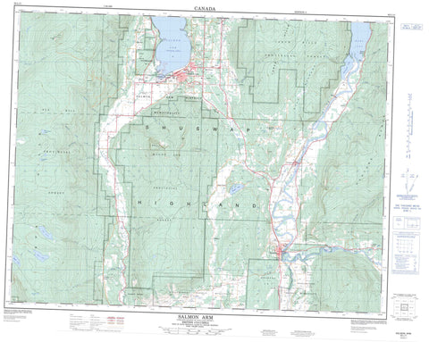
082L11 Salmon Arm Canada topo map, 1:50,000 scale
082L11 Salmon Arm NRCAN topographic map.
Includes UTM and GPS geographic coordinates (latitude and longitude). This 50k scale map is suitable for hiking, camping, and exploring, or you could frame it as a wall map.
Printed on-demand using high resolution, on heavy weight and acid free paper, or as an upgrade on a variety of synthetic materials.
Topos available on paper, Waterproof, Poly, or Tyvek. Usually shipping rolled, unless combined with other folded maps in one order.
- Product Number: NRCAN-082L11
- Parent Topo: TOPO-082L
- Map ID also known as: 082L11, 82L11
- Unfolded Size: Approximately 26" high by 36" wide
- Weight (paper map): ca. 55 grams
- Map Type: POD NRCAN Topographic Map
- Map Scale: 1:50,000
- Geographical region: British Columbia, Canada
Neighboring Maps:
All neighboring Canadian topo maps are available for sale online at 1:50,000 scale.
Purchase the smaller scale map covering this area: Topo-082L
Spatial coverage:
Topo map sheet 082L11 Salmon Arm covers the following places:
- Salmon Arm - Mallard Point - Sandy Point - Enderby - Salmon Arm - Enderby Cliffs - Spallumcheen - Enderby Indian Reserve 2 - Réserve indienne Enderby 2 - Réserve indienne Salmon River 1 - Réserve indienne Switsemalph 3 - Réserve indienne Switsemalph 6 - Réserve indienne Switsemalph 7 - Salmon River Indian Reserve 1 - Switsemalph Indian Reserve 3 - Switsemalph Indian Reserve 6 - Switsemalph Indian Reserve 7 - Main Island - Turtle Island - Arthur Lake - Bergerac Lake - Blair Lake - Bolean Lake - Gardom Lake - Kernaghan Lake - Mara Lake - Parkinson Lake - Reeves Lake - Rosemond Lake - Saltwell Lake - Schindler Lake - Silvernail Lake - Spa Lake - Waby Lake - Wallensteen Lake - Willshore Lake - Champ de tir Salmon Arm - Salmon Arm Range - Fly Hill - Hunters Range - Larch Hills - Mount Ida - Mount Wallensteen - Shuswap Highland - Spa Hills - Columbia-Shuswap Regional District - Gardom Lake Park - Mara Park - Ptarmigan Flats - Allardice Creek - Apalmer Creek - Ashton Creek - Blurton Creek - Bolean Creek - Bongard Creek - Brash Creek - Canoe Creek - Charcoal Creek - Chase Creek - Crawley Creek - Crossman Creek - Deep Creek - East Canoe Creek - Ferris Creek - Fortune Creek - Fowler Creek - Gardom Creek - Gordon Creek - Grier Creek - Haines Creek - Harland Creek - Hobson Creek - Ida Creek - Johnson Creek - Kernaghan Creek - King-Baker Creek - Lambert Creek - Larch Hills Creek - Leduc Creek - Leonard Creek - Linton Creek - Lyster Creek - McTavish Creek - Metcalfe Creek - MouttellCreek - Palmer Creek - Ptarmigan Creek - Ricardo Creek - Rogers Creek - Rumball Creek - Salmon River - Saltwell Creek - Shuswap River - Silver Creek - Slack Creek - South Gordon Creek - Spa Creek - Stephen Creek - Syphon Creek - Violet Creek - Wall Creek - Wallensteen Creek - Wilcox Creek - Ashton Creek - Broadview - Canoe - Deep Creek - Gleneden - Grandview Bench - Grindrod - Hillcrest - Hullcar - Mara - Ranchero - Salmon Arm - Silver Creek - South Canoe - Stepney - Yankee Flats - Mara Meadows


