
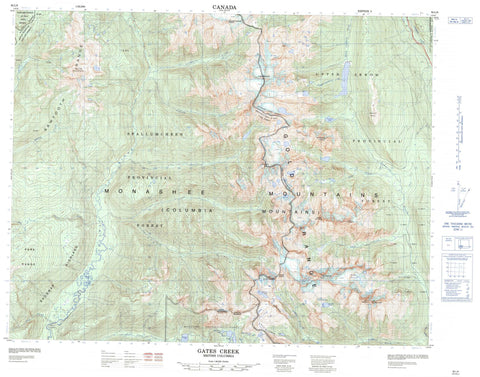
082L09 Gates Creek Canada topo map, 1:50,000 scale
082L09 Gates Creek NRCAN topographic map.
Includes UTM and GPS geographic coordinates (latitude and longitude). This 50k scale map is suitable for hiking, camping, and exploring, or you could frame it as a wall map.
Printed on-demand using high resolution, on heavy weight and acid free paper, or as an upgrade on a variety of synthetic materials.
Topos available on paper, Waterproof, Poly, or Tyvek. Usually shipping rolled, unless combined with other folded maps in one order.
- Product Number: NRCAN-082L09
- Parent Topo: TOPO-082L
- Map ID also known as: 082L09, 82L9, 82L09
- Unfolded Size: Approximately 26" high by 36" wide
- Weight (paper map): ca. 55 grams
- Map Type: POD NRCAN Topographic Map
- Map Scale: 1:50,000
- Geographical region: British Columbia, Canada
Neighboring Maps:
All neighboring Canadian topo maps are available for sale online at 1:50,000 scale.
Purchase the smaller scale map covering this area: Topo-082L
Spatial coverage:
Topo map sheet 082L09 Gates Creek covers the following places:
- Frigg Glacier - Bearpaw Lake - Coursier Lake - Dickinson Lake - Fawn Lake - Icebound Lake - Lees Lake - Little Peters Lake - Mimulus Lake - Mirror Lake - Peters Lake - Pingston Lake - Riley Lake - Spectrum Lake - Sunrise Lake - Armstrong Peak - Caribou Mountain - Columbia Mountains - Cranberry Mountain - Gates Ledge - Gates Peak - Gold Range - Heather Ridge - Hobson Peak - Hughes Peak - Kelly Peak - Laag Mountain - Monashee Mountains - Mount Burnham - Mount Grady - Mount Gunnarsen - Mount Hall - Mount Niflheim - Mount Odin - Mount Skade - Mount Thor - Paintbrush Ridge - Saturday Peak - Sawtooth Range - Shuswap Highland - Slate Mountain - Tsuius Mountain - Regional District of Central Kootenay - Monashee Park - Bill Fraser Creek - Cirque Creek - Cranberry Creek - Curwen Creek - Deer Creek - Fault Creek - Gagney Creek - Gates Creek - Hound Creek - Ledge Creek - Lindmark Creek - Little Fish Creek - Odin Creek - Oleson Creek - Pingston Creek - Ptarmigan Creek - Shuswap River - South Cranberry Creek - Spectrum Creek - Star Creek - Thor Creek - Tourmaline Creek - Tsuius Creek - Valerian Creek - Vanwyk Creek - Vigue Creek - Whip Creek - Belly Up Canyon - Caribou Pass - Marble Pass - Pika Pass - Snowdrift Pass - Valley of the Moon


