
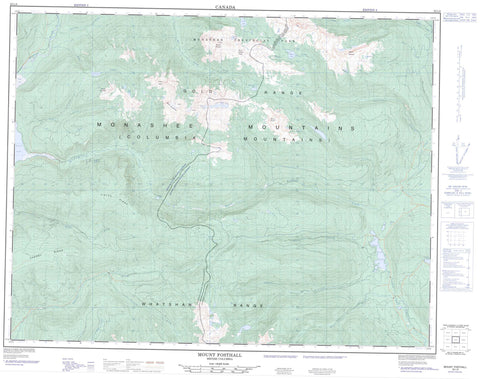
082L08 Mount Fosthall Canada topo map, 1:50,000 scale
082L08 Mount Fosthall NRCAN topographic map.
Includes UTM and GPS geographic coordinates (latitude and longitude). This 50k scale map is suitable for hiking, camping, and exploring, or you could frame it as a wall map.
Printed on-demand using high resolution, on heavy weight and acid free paper, or as an upgrade on a variety of synthetic materials.
Topos available on paper, Waterproof, Poly, or Tyvek. Usually shipping rolled, unless combined with other folded maps in one order.
- Product Number: NRCAN-082L08
- Parent Topo: TOPO-082L
- Map ID also known as: 082L08, 82L8, 82L08
- Unfolded Size: Approximately 26" high by 36" wide
- Weight (paper map): ca. 55 grams
- Map Type: POD NRCAN Topographic Map
- Map Scale: 1:50,000
- Geographical region: British Columbia, Canada
Neighboring Maps:
All neighboring Canadian topo maps are available for sale online at 1:50,000 scale.
Purchase the smaller scale map covering this area: Topo-082L
Spatial coverage:
Topo map sheet 082L08 Mount Fosthall covers the following places:
- Rainbow Falls - Arrow Park Lake - Bill Fraser Lake - Cameron Lake - Cirque Lake - Empress Lake - Iron Lake - Kate Lake - Larson Lake - Little Arrow Park Lake - Little Mosquito Lake - Margie Lake - Mosquito Lake - Paint Lake - Pete Lake - Peters Lake - Polly Lake - Rottacker Lake - Sitkum Lake - Sugar Lake - Twin Peaks Lake - Cherry Ridge - Columbia Mountains - Goat Mountain - Gold Range - Monashee Mountains - Mount Baldur - Mount Fosthall - Mount Symonds - Mount Symons - Shuswap Highland - Sugar Mountain - Symonds Mountain - Vidler Ridge - Whatshan Range - Regional District of Central Kootenay - Monashee Park - Sitkum Plateau - Arrow Park (Mosquito) Creek - Arrowpark Creek - Bill Fraser Creek - Cherry Creek - Currie Creek - Cusson Creek - Fosthall Creek - Kate Creek - Kealy Creek - Ledge Creek - Margie Creek - Mosquito Creek - Outlet Creek - Pingston Creek - Plant Creek - Rainbow Creek - Rioulx Creek - Severide Creek - Shuswap River - Sitkum Creek - South Fosthall Creek - Spectrum Creek - Sugar Creek - Sunshine Creek - Trout Creek - Vanstone Creek - Pillar Pass - South Caribou Pass


