
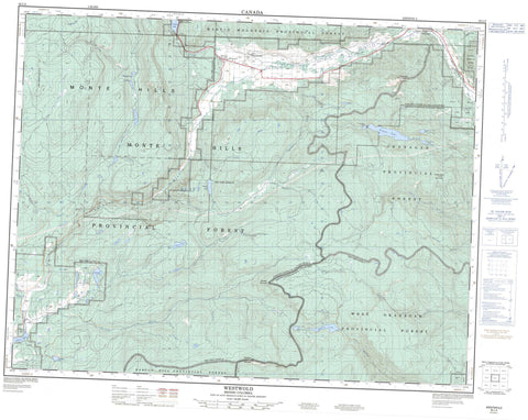
082L05 Westwold Canada topo map, 1:50,000 scale
082L05 Westwold NRCAN topographic map.
Includes UTM and GPS geographic coordinates (latitude and longitude). This 50k scale map is suitable for hiking, camping, and exploring, or you could frame it as a wall map.
Printed on-demand using high resolution, on heavy weight and acid free paper, or as an upgrade on a variety of synthetic materials.
Topos available on paper, Waterproof, Poly, or Tyvek. Usually shipping rolled, unless combined with other folded maps in one order.
- Product Number: NRCAN-082L05
- Parent Topo: TOPO-082L
- Map ID also known as: 082L05, 82L5, 82L05
- Unfolded Size: Approximately 26" high by 36" wide
- Weight (paper map): ca. 55 grams
- Map Type: POD NRCAN Topographic Map
- Map Scale: 1:50,000
- Geographical region: British Columbia, Canada
Neighboring Maps:
All neighboring Canadian topo maps are available for sale online at 1:50,000 scale.
Purchase the smaller scale map covering this area: Topo-082L
Spatial coverage:
Topo map sheet 082L05 Westwold covers the following places:
- Réserve indienne Salmon Lake 7 - Salmon Lake Indian Reserve 7 - Beautiful Lake - Bouleau Lake - Drum Lake - Jimmy Lake - Lady King Lake - Little Bouleau Lake - Little Pinaus Lake - Monte Lake - Nugget Lake - Pinaus Lake - Salmon Lake - Sawmill Lake - Square Lake - Stephens Lakes - Target Lake - Will Lake - Woods Lake - Bouleau Mountain - Monte Hills - Mount Hailstone - Mount Janicki - Siwash Rock Mountain - Tahaetkun Mountain - Tuktakamin Mountain - Columbia-Shuswap Regional District - Monte Lake Park - Pearse Park - Westwold Park - Thompson Plateau - Adelphi Creek - Bishop Creek - Blackjack Creek - Blair Creek - Bolean Creek - Bouleau Creek - Browns Creek - Cain Creek - Cress Creek - Equesis Creek - Ewer Creek - Falkland Creek - Ferris Creek - Goodwin Creek - Ingram Creek - Japan Creek - Jupiter Creek - McGregor Creek - McInnis Creek - Monte Creek - Munro Creek - Nash Creek - Naswhito Creek - Nugget Creek - Pinaus Creek - Poyntz Creek - Pringle Creek - Random Creek - Salmon River - Sunlight Creek - Teakettle Creek - Twig Creek - Warren Creek - Weyman Creek - Will Creek - Falkland - Westwold


