
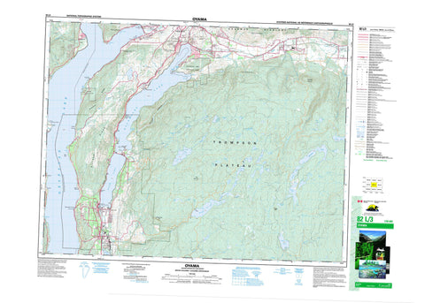
082L03 Oyama Canada topo map, 1:50,000 scale
082L03 Oyama NRCAN topographic map.
Includes UTM and GPS geographic coordinates (latitude and longitude). This 50k scale map is suitable for hiking, camping, and exploring, or you could frame it as a wall map.
Printed on-demand using high resolution, on heavy weight and acid free paper, or as an upgrade on a variety of synthetic materials.
Topos available on paper, Waterproof, Poly, or Tyvek. Usually shipping rolled, unless combined with other folded maps in one order.
- Product Number: NRCAN-082L03
- Parent Topo: TOPO-082L
- Map ID also known as: 082L03, 82L3, 82L03
- Unfolded Size: Approximately 26" high by 36" wide
- Weight (paper map): ca. 55 grams
- Map Type: POD NRCAN Topographic Map
- Map Scale: 1:50,000
- Geographical region: British Columbia, Canada
Neighboring Maps:
All neighboring Canadian topo maps are available for sale online at 1:50,000 scale.
Purchase the smaller scale map covering this area: Topo-082L
Spatial coverage:
Topo map sheet 082L03 Oyama covers the following places:
- Adventure Bay - Beachcomber Bay - Cosens Bay - Jade Bay - Juniper Bay - Otter Bay - Whiskey Cove - Cameron Point - Rattlesnake Point - Shorts Point - Turtles Head Point - Vernon - Wrinkly Face Cliff - Coldstream - Lake Country - Osoyoos Division Yale Land District - Duck Lake Indian Reserve 7 - Okanagan Indian Reserve 1 - Priest's Valley Indian Reserve 6 - Réserve indienne Duck Lake 7 - Réserve indienne Okanagan 1 - Réserve indienne Priest's Valley 6 - Grant Island - Whiskey Island - Aberdeen Lake - Aileen Lake - Alex Lake - Bear Lake - Brunette Lake - Chatterton Lake - Cochrane Lake - Crooked Lake - Curtis Lake - Damer Lake - Dee Lake - Deep Lake - Deer Lake - Doreen Lake - Echo Lake - Edwin Lake - Edwin Lakes - Ellison Lake - Flyfish Lakes - Grizzly Lake - Haddo Lake - Hayhurst Lake - Hidden Lake - High Lake - Ideal Lake - Ince Lake - Island Lake - Kaiser Bill Lake - Kalamalka Lake - King Edward Lake - Long Lake - Loon Lake - Lost Lake - Min Lake - Moore Lake - Nicklen Lake - Okanagan Lake - Oyama Lake - Park Lakes - Rankin Lake - Rod Lake - Roly Lake - Ruth Lake - Sinclair Lake - Specs Lakes - Streak Lake - Swalwell Lake - Tompson Lake - Towgood Lake - Wilma Lake - Wollaston Lake - Wood Lake - Champ de tir et champ de manoeuvre Vernon - Vernon Range and Training Area - Bluenose Mountain - Ellison Ridge - Grizzly Hill - Long Mountain - Mount Middleton - Predator Ridge - Shuswap Highland - Spion Kop - Regional District of Central Okanagan - Ellison Park - Kalamalka Lake Park - Kalamalka West Park - Kekuli Bay Park - Truman Dagnus Locheed Park - Thompson Plateau - Anderson Brook - Belgo Creek - Bessette Creek - Boltres Creek - Brew Stream - Brewer Creek - Browns Creek - Bulman Creek - Cinnabar Creek - Clark Creek - Coldstream Creek - Conroy Creek - Cosens Creek - Craster Creek - Dimetri Creek - Duteau Creek - Echo Creek - Fisbee Creek - Harris Creek - Hayton Creek - Heart Creek - Hilda Creek - Horse Creek - Kelowna Creek - Lawson Creek - Mill Creek - Mugford Creek - Nicklen Creek - Norris Creek - North Oyama Creek - Oyama Creek - Reets Creek - Reid Creek - Ribbleworth Creek - Shorts Creek - Spider Creek - Sturt Creek - Vernon Creek - Whiteman Creek - Winfield Creek - Beachcomber Bay - Caesars - Carrs - Cedar Grove - Fintry - Kalamalka - Killiney - Lavington - Lumby Junction - Nahun - Okanagan Centre - Okanagan Landing - Oyama - Pixie Beach - Whiteman Landing - Wilson Landing - Winfield - Woodsdale - Cougar Canyon - Grizzly Swamp


