
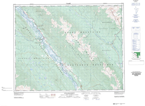
082K16 Spillimacheen Canada topo map, 1:50,000 scale
082K16 Spillimacheen NRCAN topographic map.
Includes UTM and GPS geographic coordinates (latitude and longitude). This 50k scale map is suitable for hiking, camping, and exploring, or you could frame it as a wall map.
Printed on-demand using high resolution, on heavy weight and acid free paper, or as an upgrade on a variety of synthetic materials.
Topos available on paper, Waterproof, Poly, or Tyvek. Usually shipping rolled, unless combined with other folded maps in one order.
- Product Number: NRCAN-082K16
- Parent Topo: TOPO-082K
- Map ID also known as: 082K16, 82K16
- Unfolded Size: Approximately 26" high by 36" wide
- Weight (paper map): ca. 55 grams
- Map Type: POD NRCAN Topographic Map
- Map Scale: 1:50,000
- Geographical region: British Columbia, Canada
Neighboring Maps:
All neighboring Canadian topo maps are available for sale online at 1:50,000 scale.
Purchase the smaller scale map covering this area: Topo-082K
Spatial coverage:
Topo map sheet 082K16 Spillimacheen covers the following places:
- Baldy Channel - Botts Channel - Hotsprings Channel - Big Fish Lake - Botts Lake - Burns Lake - Cartwright Lake - Cleland Lake - Cub Lake - Diana Lake - Halfway Lake - Jade Lake - Jordan Lake - Kootenay Pond - Lang Lake - Leadqueen Lake - Longs Lake - Moose Lake - Topaz Lake - Twin Lakes - Wells Lakes - Whary Lake - Beaverfoot Range - Brisco Range - Columbia Mountains - Jubilee Mountain - Kootenay Ranges - Montagnes Rocheuses - Mount Crook - Mount Norman - Mount Wardle - Purcell Mountains - Rocky Mountains - Steamboat Mountain - Vermilion Range - Columbia-Shuswap Regional District - Regional District of East Kootenay - Columbia National Wildlife Area - Kootenay National Park of Canada - Parc national du Canada Kootenay - Réserve nationale de faune de Columbia - Body Creek - Boyce Creek - Brisco Creek - Brisco Creek - Bryanton Creek - Bugaboo Creek - Cedared Creek - Columbia River - Dolly Varden Creek - Dollyvarden Creek - Driftwood Creek - Dunbar Creek - Fleuve Columbia - Fraling Creek - Frances Creek - Hatch Creek - Hot Creek - Kindersley Creek - Kootenay River - Lost Creek - Luxor Creek - McCready Creek - Meadow Creek - Outlet Creek - Paul Creek - Pinnacle Creek - Pratt Creek - Rand Creek - Soles Creek - Spillimacheen River - Symond Creek - Templeton River - Verendrye Creek - Vermilion River - Wardle Creek - Whitetail Creek - Brisco - Harrogate - Kootenay Crossing - Luxor - Spillamacheen - Spillimacheen - Hector Gorge - Luxor Pass - Rocky Mountain Trench


