
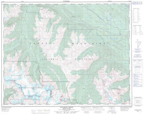
082K15 Bugaboo Creek Canada topo map, 1:50,000 scale
082K15 Bugaboo Creek NRCAN topographic map.
Includes UTM and GPS geographic coordinates (latitude and longitude). This 50k scale map is suitable for hiking, camping, and exploring, or you could frame it as a wall map.
Printed on-demand using high resolution, on heavy weight and acid free paper, or as an upgrade on a variety of synthetic materials.
Topos available on paper, Waterproof, Poly, or Tyvek. Usually shipping rolled, unless combined with other folded maps in one order.
- Product Number: NRCAN-082K15
- Parent Topo: TOPO-082K
- Map ID also known as: 082K15, 82K15
- Unfolded Size: Approximately 26" high by 36" wide
- Weight (paper map): ca. 55 grams
- Map Type: POD NRCAN Topographic Map
- Map Scale: 1:50,000
- Geographical region: British Columbia, Canada
Neighboring Maps:
All neighboring Canadian topo maps are available for sale online at 1:50,000 scale.
Purchase the smaller scale map covering this area: Topo-082K
Spatial coverage:
Topo map sheet 082K15 Bugaboo Creek covers the following places:
- Rocky Point - Baldy Channel - Bugaboo Falls - Conrad Glacier - Conrad Icefield - Vowell Glacier - Bittern Lake - Bob Lake - Climax Lake - Cobalt Lake - Gavia Lakes - Mitten Lake - Moose Lake - Nine Bay Lake - Serpent Lake - Templeton Lake - Brenta Spire - Cobalt Lake Spire - Columbia Mountains - Crescent Spire - Lead Mountain - Mount Conrad - Mount Ethelbert - Mount Kelvin - Mount Malloy - Mount Thorington - Northpost Spire - Osprey Peak - Purcell Mountains - Septet Peaks - Septet Range - Snafflehound Spire - Spear Spire - Spillimacheen Range - The Bugaboos - Vowell Peak - Wallace Peak - Columbia-Shuswap Regional District - Regional District of Central Kootenay - Regional District of East Kootenay - Bugaboo Alpine Recreation Area - Bugaboo Park - Bobbie Burns Creek - Columbia River - Conrad Creek - Crystalline Creek - Driftwood Creek - Dunbar Creek - Fleuve Columbia - Giegerich Creek - Hemlock Creek - Hobo Creek - Kain Creek - Malachite Creek - Malloy Creek - Poet Creek - Rand Creek - Rockypoint Creek - Septet Creek - Spillimacheen River - Templeton River - Vermont Creek - Vowell Creek - Warren Creek - Rocky Mountain Trench


