
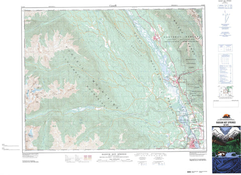
082K09 Radium Hot Springs Canada topo map, 1:50,000 scale
082K09 Radium Hot Springs NRCAN topographic map.
Includes UTM and GPS geographic coordinates (latitude and longitude). This 50k scale map is suitable for hiking, camping, and exploring, or you could frame it as a wall map.
Printed on-demand using high resolution, on heavy weight and acid free paper, or as an upgrade on a variety of synthetic materials.
Topos available on paper, Waterproof, Poly, or Tyvek. Usually shipping rolled, unless combined with other folded maps in one order.
- Product Number: NRCAN-082K09
- Parent Topo: TOPO-082K
- Map ID also known as: 082K09, 82K9, 82K09
- Unfolded Size: Approximately 26" high by 36" wide
- Weight (paper map): ca. 55 grams
- Map Type: POD NRCAN Topographic Map
- Map Scale: 1:50,000
- Geographical region: British Columbia, Canada
Neighboring Maps:
All neighboring Canadian topo maps are available for sale online at 1:50,000 scale.
Purchase the smaller scale map covering this area: Topo-082K
Spatial coverage:
Topo map sheet 082K09 Radium Hot Springs covers the following places:
- Invermere - Shannon Glacier - Réserve indienne Shuswap - Shuswap Indian Reserve - Baptiste Lake - Barbour Lake - Dogsleg Lake - Eire Lake - Hall Lakes - Irish Lake - Lake Eileen - Lake Enid - Lillian Lake - Long Lake - Lower Halgrave Lake - Northcote Lake - Steamboat Lake - Tara Lake - Upper Halgrave Lake - Wilmer Lake - Windermere Lake - Antrim Peak - Banshee Tower - Brisco Range - Columbia Mountains - Connemara Peak - Donard Peak - Donegal Peak - Dublin Spire - Farnham Ridge - Irish Peaks - Killarney Peak - Koala Peak - Kootenay Ranges - Leitrim Peak - Medenagan Mountain - Meden-Agan Mountain - Mount Berland - Mount Bruce - Mount Cuchulainn - Mount Forster - Mount Johnston - Mount Kindersley - Mount Law - Mount Sally Serena - Mount Scarlett O'Hara - Parker Peak - Purcell Mountains - Redstreak Mountain - Serrate Mountain - Stanford Range - Starbird Ridge - Steamboat Mountain - Athalmer Beach Park - Dry Gulch Park - James Chabot Park - Kootenae House National Historic Site of Canada - Kootenay National Park of Canada - Lieu historique national du Canada Kootenae House - Parc national du Canada Kootenay - Akenside Creek - Andreen Creek - Bruce Creek - Castor Creek - Columbia River - Dry Gulch Creek - Fan Creek - Fleuve Columbia - Forster Creek - Frances Creek - Geddes Creek - Gopher Creek - Gulch Creek - Haultain Creek - Horsethief Creek - Hurst Creek - Irish Creek - Isaac Creek - John McKay Creek - Kindersley Creek - Law Creek - Luxor Creek - Macaulay Creek - McDonald Creek - Meadow Creek - Neave Creek - North Hurst Creek - Ogelston Creek - Palmer Creek - Red Line Creek - Serena Creek - Shuswap Creek - Sinclair Creek - Stockdale Creek - Stoddart Creek - Toby Creek - Welsh Creek - Wilmer Creek - Radium Hot Springs - Athalmer - Dry Gulch - Edgewater - Lake Windermere - Radium - Radium Junction - Shuswap - Wilmer - Windermere - Rocky Mountain Trench - Sinclair Canyon - Radium Hot Springs


