
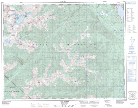
082K08 Toby Creek Canada topo map, 1:50,000 scale
082K08 Toby Creek NRCAN topographic map.
Includes UTM and GPS geographic coordinates (latitude and longitude). This 50k scale map is suitable for hiking, camping, and exploring, or you could frame it as a wall map.
Printed on-demand using high resolution, on heavy weight and acid free paper, or as an upgrade on a variety of synthetic materials.
Topos available on paper, Waterproof, Poly, or Tyvek. Usually shipping rolled, unless combined with other folded maps in one order.
- Product Number: NRCAN-082K08
- Parent Topo: TOPO-082K
- Map ID also known as: 082K08, 82K8, 82K08
- Unfolded Size: Approximately 26" high by 36" wide
- Weight (paper map): ca. 55 grams
- Map Type: POD NRCAN Topographic Map
- Map Scale: 1:50,000
- Geographical region: British Columbia, Canada
Neighboring Maps:
All neighboring Canadian topo maps are available for sale online at 1:50,000 scale.
Purchase the smaller scale map covering this area: Topo-082K
Spatial coverage:
Topo map sheet 082K08 Toby Creek covers the following places:
- Invermere - Delphine Glacier - Bunyan Lake - Dorothy Lake - Paddy Ryan Lakes - Shamrock Lake - Windermere Lake - Black Diamond Mountain - Columbia Mountains - Coppercrown Mountain - Coppercrown Peak - Farnham Ridge - Farnham Tower - McCoubrey Mountain - Monument Peak - Mount Abel - Mount Brewer - Mount Catherine - Mount Delphine - Mount Farnham - Mount Goldie - Mount Hammond - Mount McCoubrey - Mount Nelson - Mount Peter - Mount Slade - Mount Taynton - Panorama Mountain - Pharaoh Peaks - Purcell Mountains - Red Line Peak - Slade Mountain - Spearhead Peak - Sultana Peak - Watch Peak - Regional District of East Kootenay - Purcell Wilderness Conservancy - Abel Creek - Barbour Creek - Ben Abel Creek - Brady Creek - Brewer Creek - Bruce Creek - Clearwater Creek - Columbia River - Coppercrown Creek - Delphine Creek - Dutch Creek - Farnham Creek - Fleuve Columbia - Goldie Creek - Holland Creek - Hopeful Creek - Jumbo Creek - Kreuter Creek - Laundry Creek - Law Creek - McDonald Creek - Mineral Creek - Pharaoh Creek - Pharoah Creek - Red Line Creek - Salter Creek - South Toby Creek - Springs Creek - Stark Creek - Sultana Creek - Sunlight Creek - Taynton Creek - Thorald Creek - Toby Creek - Goldie Creek - Panorama - Toby Creek - Peter Pass - Rocky Mountain Trench


