
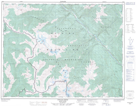
082K06 Poplar Creek Canada topo map, 1:50,000 scale
082K06 Poplar Creek NRCAN topographic map.
Includes UTM and GPS geographic coordinates (latitude and longitude). This 50k scale map is suitable for hiking, camping, and exploring, or you could frame it as a wall map.
Printed on-demand using high resolution, on heavy weight and acid free paper, or as an upgrade on a variety of synthetic materials.
Topos available on paper, Waterproof, Poly, or Tyvek. Usually shipping rolled, unless combined with other folded maps in one order.
- Product Number: NRCAN-082K06
- Parent Topo: TOPO-082K
- Map ID also known as: 082K06, 82K6, 82K06
- Unfolded Size: Approximately 26" high by 36" wide
- Weight (paper map): ca. 55 grams
- Map Type: POD NRCAN Topographic Map
- Map Scale: 1:50,000
- Geographical region: British Columbia, Canada
Neighboring Maps:
All neighboring Canadian topo maps are available for sale online at 1:50,000 scale.
Purchase the smaller scale map covering this area: Topo-082K
Spatial coverage:
Topo map sheet 082K06 Poplar Creek covers the following places:
- Tenderfoot Glacier - Blue Lake - Kay Lake - Logus Lake - Tenderfoot Lake - Badshot Range - Cascade Mountain - Clark Peak - Columbia Mountains - Duncan Ranges - Gallo Peak - Goat Range - Howser Ridge - Lardeau Range - Meadow Mountain - Mount Bentley - Mount Emmens - Mount Johnson - Mount Johnston - Mount Keen - Mount Marion - Mount Wilkie - Selkirk Mountains - Spyglass Mountain - Superposed Mountain - Tenderfoot Mountain - The Ramparts - Regional District of Central Kootenay - Goat Range Park - Trout Lake Park - Abrahamson Creek - Benson Creek - Burkitt Creek - Cascade Creek - Craig Creek - Deception Creek - Deep Creek - Healy Creek - Hope Creek - Hunter Creek - John Creek - Kuskanax Creek - Lake Creek - Lardeau River - Mat Creek - McKian Creek - Meadow Creek - Mobbs Creek - Morgan Creek - Poplar Creek - Rapid Creek - Rogers Creek - Rusty Creek - Tenderfoot Creek - Wood Creek - Gold Hill - Poplar Creek


