
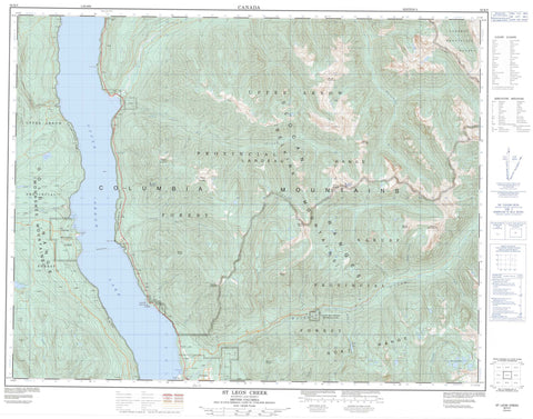
082K05 St Leon Creek Canada topo map, 1:50,000 scale
082K05 St Leon Creek NRCAN topographic map.
Includes UTM and GPS geographic coordinates (latitude and longitude). This 50k scale map is suitable for hiking, camping, and exploring, or you could frame it as a wall map.
Printed on-demand using high resolution, on heavy weight and acid free paper, or as an upgrade on a variety of synthetic materials.
Topos available on paper, Waterproof, Poly, or Tyvek. Usually shipping rolled, unless combined with other folded maps in one order.
- Product Number: NRCAN-082K05
- Parent Topo: TOPO-082K
- Map ID also known as: 082K05, 82K5, 82K05
- Unfolded Size: Approximately 26" high by 36" wide
- Weight (paper map): ca. 55 grams
- Map Type: POD NRCAN Topographic Map
- Map Scale: 1:50,000
- Geographical region: British Columbia, Canada
Neighboring Maps:
All neighboring Canadian topo maps are available for sale online at 1:50,000 scale.
Purchase the smaller scale map covering this area: Topo-082K
Spatial coverage:
Topo map sheet 082K05 St Leon Creek covers the following places:
- Farm Bay - Fosthall Bay - Telegraph Bay - Ann Point - Cape Horn - Fosthall Point - Ione Falls - Cameron Lake - Catherine Lake - Grady Lake - Hamling Lakes - Kimbol Lake - Upper Arrow Lake - Columbia Mountains - Goat Range - Kuskanax Mountain - Lardeau Range - Monashee Mountains - Mount Abriel - Mount Benton - Mount Herridge - Mount Hohenleitner - Mount Islip - Mount Jordan - Mount Leary - Mount Sanderson - Mount Shelling - Mount St. Leon - Mount Steenhoff - Selkirk Mountains - Regional District of Central Kootenay - Nakusp Hot Springs Park - Adams Creek - Brouse Creek - Cape Horn Creek - Coates Creek - Columbia River - Dunn Creek - Fitzstubbs Creek - Fleuve Columbia - Fosthall Creek - Gardner Creek - Halfway Creek - Halfway River - Hamling Creek - Henry Creek - Ione Creek - Kelly Creek - Kiln Creek - Kimbol Creek - Kuskanax Creek - Ledge Creek - Lone Creek - MacLeod Creek - Mobbs Creek - Moon Creek - Pingston Creek - Raven Creek - Sob Creek - St. Leon Creek - Sunshine Creek - Trout Creek - Turnbull Creek - Turner Creek - Vanstone Creek - Wensley Creek - Wood Creek - Nakusp Hot Springs - St. Leon Hot Springs - Fosthall - Glenbank - Leon - Pingston - Shoreholme - St. Leon


