
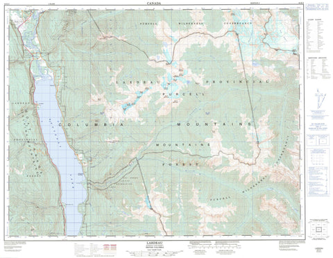
082K02 Lardeau Canada topo map, 1:50,000 scale
082K02 Lardeau NRCAN topographic map.
Includes UTM and GPS geographic coordinates (latitude and longitude). This 50k scale map is suitable for hiking, camping, and exploring, or you could frame it as a wall map.
Printed on-demand using high resolution, on heavy weight and acid free paper, or as an upgrade on a variety of synthetic materials.
Topos available on paper, Waterproof, Poly, or Tyvek. Usually shipping rolled, unless combined with other folded maps in one order.
- Product Number: NRCAN-082K02
- Parent Topo: TOPO-082K
- Map ID also known as: 082K02, 82K2, 82K02
- Unfolded Size: Approximately 26" high by 36" wide
- Weight (paper map): ca. 55 grams
- Map Type: POD NRCAN Topographic Map
- Map Scale: 1:50,000
- Geographical region: British Columbia, Canada
Neighboring Maps:
All neighboring Canadian topo maps are available for sale online at 1:50,000 scale.
Purchase the smaller scale map covering this area: Topo-082K
Spatial coverage:
Topo map sheet 082K02 Lardeau covers the following places:
- Fry Point - Schroeder Point - Hamill Glacier - Toby Glacier - Clute Lake - Eagle Nest Lake - Kootenay Lake - Lake Bonny Gem - Marten Lake - Milford Lake - Weasel Lakes - Bacchus Ridge - Blue Ridge - Columbia Mountains - Comb Mountain - Eagle Spire - Goat Range - Griswold Peak - Kootenay Joe Ridge - Mammary Peak - Milford Peak - Mount Abey - Mount Beguin - Mount Bulmer - Mount Christine - Mount Clark - Mount Fitzsimmons - Mount Hamill - Mount Katherine - Mount Lady Grey - Mount Lake - Mount Lillian - Mount Macnicol - Mount Mason - Mount McLanders - Mount McLeod - Mount Pambrun - Mount Rasmussen - Mount Sauczuk - Mount Toby - Mount Tyrrell - Mount Wilkinson - Mount Willet - Purcell Mountains - Selkirk Mountains - The Steeds - Tooth Ridge - Winter Peak - Regional District of Central Kootenay - Regional District of East Kootenay - Fry Creek Canyon Recreation Area - Kootenay Lake Park - Kootenay Lake Recreation Area - Lardeau Park - Purcell Wilderness Conservancy - Argenta Creek - Bulmer Creek - Carney Creek - Carter Creek - Clint Creek - Clute Creek - Cooper Creek - Crazy Creek - Davis Creek - Duncan River - Fry Creek - Gar Creek - Gardner Creek - Gillis Creek - Granitic Creek - Greasy Rocks Creek - Hamill Creek - Kootenay Joe Creek - Lardeau River - Lillian Creek - Lost Ledge Creek - Lunch Creek - McLaughlin Creek - Meadow Creek - Milford Creek - Murphy Creek - Noel Creek - Pambrun Creek - Pinnacle Creek - Pork Creek - Quart Creek - Salisbury Creek - Schroeder Creek - Smallfry Creek - Stanley Creek - Ten Mile Creek - Toby Creek - Argenta - Birchdale - Cooper Creek - Fry Creek - Johnsons Landing - Johnson's Landing - Lardeau - Marble Head - Marblehead - Meadow Creek - Kootenay Joe Pass


