
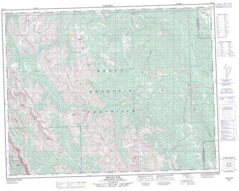
082J10 Mount Rae Canada topo map, 1:50,000 scale
082J10 Mount Rae NRCAN topographic map.
Includes UTM and GPS geographic coordinates (latitude and longitude). This 50k scale map is suitable for hiking, camping, and exploring, or you could frame it as a wall map.
Printed on-demand using high resolution, on heavy weight and acid free paper, or as an upgrade on a variety of synthetic materials.
Topos available on paper, Waterproof, Poly, or Tyvek. Usually shipping rolled, unless combined with other folded maps in one order.
- Product Number: NRCAN-082J10
- Parent Topo: TOPO-082J
- Map ID also known as: 082J10, 82J10
- Unfolded Size: Approximately 26" high by 36" wide
- Weight (paper map): ca. 55 grams
- Map Type: POD NRCAN Topographic Map
- Map Scale: 1:50,000
- Geographical region: Alberta, Canada
Neighboring Maps:
All neighboring Canadian topo maps are available for sale online at 1:50,000 scale.
Purchase the smaller scale map covering this area: Topo-082J
Spatial coverage:
Topo map sheet 082J10 Mount Rae covers the following places:
- Edworthy Falls - Sheep River Falls - Burns Lake - Lake Rae - Picklejar Lakes - Running Rain Lake - Talus Lake - Tombstone Lakes - Allsmoke Mountain - Banded Peak - Blue Ridge - Bluerock Mountain - Cougar Mountain - Elk Mountains - Elk Range - Elk Range - Gibraltar Mountain - Green Mountain - Highwood Range - Junction Mountain - Missinglink Mountain - Mist Mountain - Misty Range - Montagnes Rocheuses - Mount Arethusa - Mount Burns - Mount Cornwall - Mount Dyson - Mount Hoffman - Mount Lipsett - Mount McNab - Mount Rae - Mount Rose - Mount Ware - Pyriform Mountain - Rocky Mountain Foothills - Rocky Mountains - Storelk Mountain - Storelk Mountain - Storm Mountain - Threepoint Mountain - Volcano Ridge - Municipal District of Foothills No. 31 - Regional District of East Kootenay - Improvement District No. 5 - Kananaskis Improvement District - Kananaskis Provincial Park - Peter Lougheed Provincial Park - Sheep River Provincial Park - Bluerock Creek - Burns Creek - Cliff Creek - Coal Creek - Cougar Creek - Death Valley Creek - Dyson Creek - Elbow River - Elk River - Gorge Creek - Highwood River - Junction Creek - Lantern Creek - Link Creek - Little Elbow River - Long Prairie Creek - Macabee Creek - March Creek - Mist Creek - North Coal Creek - North Sullivan Creek - Picklejar Creek - Piper Creek - Rae Creek - Rock Creek - Sheep River - South Coal Creek - South Glasgow Creek - South Sullivan Creek - Storm Creek - Sullivan Creek - Threepoint Creek - Tom Trotter Creek - Volcano Creek - Ware Creek - Wolf Creek - Highwood Pass - Nash Meadow


