
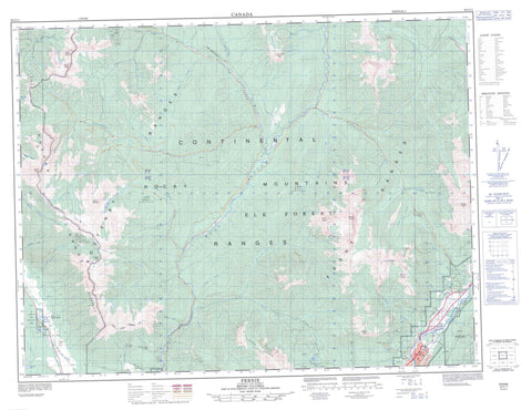
082G11 Fernie Canada topo map, 1:50,000 scale
082G11 Fernie NRCAN topographic map.
Includes UTM and GPS geographic coordinates (latitude and longitude). This 50k scale map is suitable for hiking, camping, and exploring, or you could frame it as a wall map.
Printed on-demand using high resolution, on heavy weight and acid free paper, or as an upgrade on a variety of synthetic materials.
Topos available on paper, Waterproof, Poly, or Tyvek. Usually shipping rolled, unless combined with other folded maps in one order.
- Product Number: NRCAN-082G11
- Parent Topo: TOPO-082G
- Map ID also known as: 082G11, 82G11
- Unfolded Size: Approximately 26" high by 36" wide
- Weight (paper map): ca. 55 grams
- Map Type: POD NRCAN Topographic Map
- Map Scale: 1:50,000
- Geographical region: British Columbia, Canada
Neighboring Maps:
All neighboring Canadian topo maps are available for sale online at 1:50,000 scale.
Purchase the smaller scale map covering this area: Topo-082G
Spatial coverage:
Topo map sheet 082G11 Fernie covers the following places:
- Fernie - Alkaline Lake - Cliff Lake - Hartley Lake - Island Lake - Nicol Lake - Norbury Lake - Norbury Lakes - Peckhams Lake - Bull Mountain - Goat Haven Peak - Hughes Range - Hungary Peak - Kootenay Ranges - Lizard Range - Montagnes Rocheuses - Mount Bisaro - Mount Fernie - Mount Fisher - Mount Haley - Mount Hosmer - Mount Klauer - Mount Lum - Mount Patmore - Mount Procter - Mount Sneath - Rocky Mountains - The Steeples - The Steeples Mountains - Three Sisters - Regional District of East Kootenay - Elk River Park - Norbury Lake Park - Baldrey Creek - Barrier Creek - Bean Creek - Boulder Creek - Bull River - Burntbridge Creek - Clay Creek - Crowe Creek - Dibble Creek - Dock Creek - Donely Creek - Dooley Creek - Duncan Creek - East Iron Creek - East Sulphur Creek - East Wild Horse River - Elk River - Ervine Creek - Fairy Creek - Galbraith Creek - Green Creek - Hartley Creek - Hearne Creek - Highway Creek - Horseshoe Creek - Hospital Creek - Iron Creek - Labelle Creek - Lime Creek - Little Bull Creek - Lizard Creek - Lum Creek - Mause Creek - Murdoch Creek - Mutz Creek - Norbury Creek - North Galbraith Creek - Oliva Creek - Olivia Creek - Outlook Creek - Oveson Creek - Sulphur Creek - Summer Creek - Sunken Creek - Tanglefoot Creek - Van Creek - Wallinger Creek - Hartley Pass - Rocky Mountain Trench


