
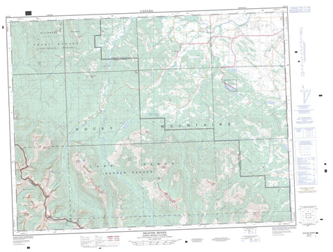
082G08 Beaver Mines Canada topo map, 1:50,000 scale
082G08 Beaver Mines NRCAN topographic map.
Includes UTM and GPS geographic coordinates (latitude and longitude). This 50k scale map is suitable for hiking, camping, and exploring, or you could frame it as a wall map.
Printed on-demand using high resolution, on heavy weight and acid free paper, or as an upgrade on a variety of synthetic materials.
Topos available on paper, Waterproof, Poly, or Tyvek. Usually shipping rolled, unless combined with other folded maps in one order.
- Product Number: NRCAN-082G08
- Parent Topo: TOPO-082G
- Map ID also known as: 082G08, 82G8, 82G08
- Unfolded Size: Approximately 26" high by 36" wide
- Weight (paper map): ca. 55 grams
- Map Type: POD NRCAN Topographic Map
- Map Scale: 1:50,000
- Geographical region: Alberta, Canada
Neighboring Maps:
All neighboring Canadian topo maps are available for sale online at 1:50,000 scale.
Purchase the smaller scale map covering this area: Topo-082G
Spatial coverage:
Topo map sheet 082G08 Beaver Mines covers the following places:
- Barnaby Lake - Beauvais Lake - Beaver Mines Lake - Butcher's Lake - Daigle Lake - Fish Lake - Grizzly Lake - Marna Lake - Southfork Lakes - Barnaby Ridge - Blairmore Range - Border Ranges - Border Ranges - Carbondale Hill - Castle Peak - Cherry Hill - Christie Mine Ridge - Clark Range - Clark Range - Clarke Range - Drywood Mountain - Ginger Hill - Gravenstafel Ridge - Hastings Ridge - Lys Ridge - Maverick Hill - Montagnes Rocheuses - Montagnes Rocheuses - Mount Backus - Mount Gladstone - Mount Haig - Mount Haig - Mount McCarty - North Castle - Pincher Ridge - Prairie Bluff - Rainy Ridge - Rainy Ridge - Rocky Mountain Foothills - Rocky Mountains - Rocky Mountains - Southfork Mountain - St. Eloi Mountain - St. Eloi Mountain - Syncline Mountain - Table Mountain - Tombstone Mountain - Victoria Peak - West Castle - Whistler Mountain - Windsor Mountain - Windsor Ridge - Municipal District of Pincher Creek No. 9 - Regional District of East Kootenay - Improvement District No. 40 - Improvement District No. 6 - Improvement District of Ranchland No. 6 - Beauvais Lake Provincial Park - Alberta - Barnaby Creek - Beaver Mines Creek - Byron Creek - Carbondale River - Castle River - Cate Creek - Chipman Creek - Drywood Creek - Gardiner Creek - Gladstone Creek - Goat Creek - Gravenstafel Brook - Grizzly Creek - Haig Brook - Jackson Creek - Lost Creek - Lynx Creek - Middlepass Creek - Mill Creek - Nigger Creek - North Lost Creek - Pincher Creek - Screwdriver Creek - South Drywood Creek - South Drywood River - South Lost Creek - Spionkop Creek - St. Eloi Brook - Suicide Creek - Syncline Brook - West Castle River - Whitney Creek - Crowsnest Pass - Beaver Mines - Middle Kootenay Pass - Middle Kootenay Pass


