
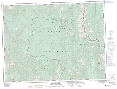
082G07 Flathead Ridge Canada topo map, 1:50,000 scale
082G07 Flathead Ridge NRCAN topographic map.
Includes UTM and GPS geographic coordinates (latitude and longitude). This 50k scale map is suitable for hiking, camping, and exploring, or you could frame it as a wall map.
Printed on-demand using high resolution, on heavy weight and acid free paper, or as an upgrade on a variety of synthetic materials.
Topos available on paper, Waterproof, Poly, or Tyvek. Usually shipping rolled, unless combined with other folded maps in one order.
- Product Number: NRCAN-082G07
- Parent Topo: TOPO-082G
- Map ID also known as: 082G07, 82G7, 82G07
- Unfolded Size: Approximately 26" high by 36" wide
- Weight (paper map): ca. 55 grams
- Map Type: POD NRCAN Topographic Map
- Map Scale: 1:50,000
- Geographical region: Alberta, Canada
Neighboring Maps:
All neighboring Canadian topo maps are available for sale online at 1:50,000 scale.
Purchase the smaller scale map covering this area: Topo-082G
Spatial coverage:
Topo map sheet 082G07 Flathead Ridge covers the following places:
- Barnes Lake - Harvey Lake - Lodgepole Lake - Border Ranges - Border Ranges - Centre Mountain - Clark Range - Clark Range - Clarke Range - Coal Mountain - Flathead Range - Flathead Range - Flathead Ridge - Galton Range - Hellebeke Mountain - Hollebeke Mountain - Hollebeke Mountain - Leach Ridge - Limestone Ridge - Macdonald Range - Michel Ridge - Montagnes Rocheuses - Montagnes Rocheuses - Morrissey Ridge - Mount Borsato - Mount Broadwood - Mount Corrigan - Mount Darrah - Mount Darrah - Mount McCarty - Packhorse Peak - Piaysoo Ridge - Rocky Mountains - Rocky Mountains - Taylor Range - Windfall Mountain - Municipal District of Pincher Creek No. 9 - Regional District of East Kootenay - Improvement District of Ranchland No. 6 - Abode Creek - Akan Creek - Bean Creek - Blower Creek - Branch Creek - Bray Creek - Buzz Creek - Campsite Creek - Carbondale River - Cate Creek - Coal Creek - Corbin Creek - Flathead River - Foisey Creek - Fuel Creek - Goat Creek - Harvey Creek - Kisoo Creek - Leach Creek - Lodgepole Creek - Macdonald Creek - Matheson Creek - McEvoy Creek - McLatchie Creek - Michel Creek - Morris Creek - Morrissey Creek - North Lodgepole Creek - North Lost Creek - Packhorse Creek - Pincher Creek - Pineclad Creek - Pioneer Creek - Pollock Creek - Pylon Creek - Rockcleft Creek - Shepp Creek - South Lost Creek - Sportsman Creek - Squaw Creek - St. Eloi Brook - Turret Creek - West Kisoo Creek - Wigwam River - Coal Creek - Flathead - Flathead Pass - Harvey Pass - Kisoo Pass - North Kootenay Pass - North Kootenay Pass


