
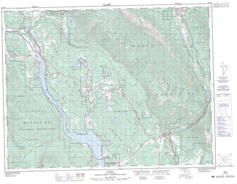
082G06 Elko Canada topo map, 1:50,000 scale
082G06 Elko NRCAN topographic map.
Includes UTM and GPS geographic coordinates (latitude and longitude). This 50k scale map is suitable for hiking, camping, and exploring, or you could frame it as a wall map.
Printed on-demand using high resolution, on heavy weight and acid free paper, or as an upgrade on a variety of synthetic materials.
Topos available on paper, Waterproof, Poly, or Tyvek. Usually shipping rolled, unless combined with other folded maps in one order.
- Product Number: NRCAN-082G06
- Parent Topo: TOPO-082G
- Map ID also known as: 082G06, 82G6, 82G06
- Unfolded Size: Approximately 26" high by 36" wide
- Weight (paper map): ca. 55 grams
- Map Type: POD NRCAN Topographic Map
- Map Scale: 1:50,000
- Geographical region: British Columbia, Canada
Neighboring Maps:
All neighboring Canadian topo maps are available for sale online at 1:50,000 scale.
Purchase the smaller scale map covering this area: Topo-082G
Spatial coverage:
Topo map sheet 082G06 Elko covers the following places:
- Fernie - Blue Bottom Lake - Bronze Lake - Darling Lake - Deer Lake - Douglas Lake - HahaLake - Lake Koocanusa - Lund Lake - Murray Lake - North Star Lake - Rosen Lake - Sand Lake - Silver Spring Lake - Suzanne Lake - Tie Lake - Wapiti Lake - Border Ranges - Columbia Mountains - Lizard Range - McGillivray Range - Montagnes Rocheuses - Morrissey Ridge - Plumbob Mountain - Purcell Mountains - Rocky Mountains - Sheep Mountain - Regional District of East Kootenay - Elk River Park - Elko Park - Kikomun Creek Park - Morrissey Park - Mount Fernie Park - Wardner Park - Agnew Creek - Ahkuttock Creek - Brewery Creek - Bull River - Burntbridge Creek - Caithness Creek - Callagham Creek - Chipka Creek - Chlopan Creek - Coal Creek - Cokato Creek - Edith Creek - Elk River - Gold Creek - Haha Creek - Hislop Creek - Kikomun Creek - Kootenay River - Liphardt Creek - Little Bull Creek - Little Sand Creek - Lizard Creek - Mack Creek - McDermid Creek - Morrissey Creek - Norbury Creek - Pennock Creek - Plumbob Creek - Rocky Creek - Sand Creek - Supply Creek - Suzanne Creek - Swamp Creek - Tepee Creek - Tunnel Creek - Whimster Creek - Wigwam River - Big Sand Creek - Bull River - Caithness - Cokato - Colvalli - Courier - Elko - Galloway - Hanbury - Jaffray - Jukeson - Morrissey - Tokay - Wardner - Rocky Mountain Trench


