
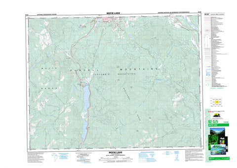
082G05 Moyie Lake Canada topo map, 1:50,000 scale
082G05 Moyie Lake NRCAN topographic map.
Includes UTM and GPS geographic coordinates (latitude and longitude). This 50k scale map is suitable for hiking, camping, and exploring, or you could frame it as a wall map.
Printed on-demand using high resolution, on heavy weight and acid free paper, or as an upgrade on a variety of synthetic materials.
Topos available on paper, Waterproof, Poly, or Tyvek. Usually shipping rolled, unless combined with other folded maps in one order.
- Product Number: NRCAN-082G05
- Parent Topo: TOPO-082G
- Map ID also known as: 082G05, 82G5, 82G05
- Unfolded Size: Approximately 26" high by 36" wide
- Weight (paper map): ca. 55 grams
- Map Type: POD NRCAN Topographic Map
- Map Scale: 1:50,000
- Geographical region: British Columbia, Canada
Neighboring Maps:
All neighboring Canadian topo maps are available for sale online at 1:50,000 scale.
Purchase the smaller scale map covering this area: Topo-082G
Spatial coverage:
Topo map sheet 082G05 Moyie Lake covers the following places:
- Cranbrook - Cassimayooks (Mayook) Indian Reserve 5 - Cassimayooks Indian Reserve 5 - Réserve indienne Cassimayooks (Mayook) 5 - Réserve indienne Cassimayooks 5 - Bednorski Lake - Edith Lake - Elizabeth Lake - Hiawatha Lake - Jim Smith Lake - Kiakho Lake - Kiakho Lakes - Kiaklo Lake - Mineral Lake - Monroe Lake - Moyie Lake - Negro Lake - Nigger Lake - Pyatts Lake - Columbia Mountains - Cranbrook Mountain - McGillivray Range - Mount Baker - Mount Casey - Mount Connell - Mount Joseph - Moyie Mountain - Moyie Range - Purcell Mountains - Regional District of East Kootenay - Jim Smith Lake Park - Jimsmith Lake Park - Moyie Lake Park - Andrea Creek - Angus Creek - Arnold Creek - Barkshanty Creek - Beatie Creek - Boulder Creek - Braunagel Creek - Chipka Creek - Cotton Creek - Doran Creek - Edith Creek - Etna Creek - Farrell Creek - Glencairn Creek - Gold Creek - Gold Hill Creek - Haha Creek - Hogg Creek - Jim Smith Creek - Jimsmith Creek - Joseph Creek - Katlsa Creek - Kiakho Creek - Kootenay River - Lake Creek - Lamb Creek - Little Lamb Creek - Mayook Creek - Monroe Creek - Moyie River - Negro Creek - Nigger Creek - Noke Creek - Oke Creek - Palmer Bar Creek - Peavine Creek - Prudhomme Creek - Rabbit Foot Creek - Salesbury Creek - Scott Creek - Semlin Creek - Tate Creek - Tepee Creek - Whitney Creek - Wuho Creek - Aldridge - Baker - Fassiferne - Fenwick - Jerome - Lumberton - Mayook - Moyie - Rockyview - Swansea - Rocky Mountain Trench - Cranbrook Marsh


