
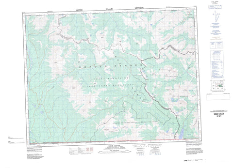
082G01 Sage Creek Canada topo map, 1:50,000 scale
082G01 Sage Creek NRCAN topographic map.
Includes UTM and GPS geographic coordinates (latitude and longitude). This 50k scale map is suitable for hiking, camping, and exploring, or you could frame it as a wall map.
Printed on-demand using high resolution, on heavy weight and acid free paper, or as an upgrade on a variety of synthetic materials.
Topos available on paper, Waterproof, Poly, or Tyvek. Usually shipping rolled, unless combined with other folded maps in one order.
- Product Number: NRCAN-082G01
- Parent Topo: TOPO-082G
- Map ID also known as: 082G01, 82G1, 82G01
- Unfolded Size: Approximately 26" high by 36" wide
- Weight (paper map): ca. 55 grams
- Map Type: POD NRCAN Topographic Map
- Map Scale: 1:50,000
- Geographical region: Alberta, Canada
Neighboring Maps:
All neighboring Canadian topo maps are available for sale online at 1:50,000 scale.
Purchase the smaller scale map covering this area: Topo-082G
Spatial coverage:
Topo map sheet 082G01 Sage Creek covers the following places:
- Blakiston Falls - Akamina Lake - Ashman Lake - Bovin Lake - Cameron Lake - Forum Lake - Goat Lake - Grizzly Lake - Jake Smith Lake - Lineham Lakes - Little Cameron Lake - Lone Lake - Lost Lake - Lost Lake - Lower Rowe Lake - Lys Lake - North Scarpe Lake - Procter Lake - Rainy Lakes - Ruby Lake - Ruby Lake - South Scarpe Lake - Starvation Lake - Summit Lake - Thomson Lake - Twin Lakes - Upper Rowe Lake - Wall Lake - West Scarpe Lake - Akamina Ridge - Anderson Peak - Avion Ridge - Border Ranges - Border Ranges - Buchanan Ridge - Cameron Mountain - Cameronian Mountain - Clark Range - Clark Range - Clarke Range - Cloudy Ridge - Commerce Peak - Festubert Mountain - Festubert Mountain - Flanders Mountain - Font Mountain - Font Mountain - Forum Peak - Forum Peak - Jutland Mountain - Kenow Mountain - King Edward Peak - Kishinena Mountains - Kishinena Peak - Kishinena Peak - Kishinena Ridge - La Coulotte Peak - La Coulotte Peak - La Coulotte Ridge - La Coulotte Ridge - Langemarck Mountain - Loaf Mountain - Lone Mountain - Lost Mountain - Lys Ridge - Miskwasini Peak - Montagnes Rocheuses - Montagnes Rocheuses - Mount Bauerman - Mount Blakiston - Mount Carthew - Mount Glendowan - Mount Hawkins - Mount Lineham - Mount Matkin - Mount Matkin - Mount Rowe - Mount Yarrell - Newman Peak - Pincher Ridge - Rainy Ridge - Rainy Ridge - Rocky Mountain Foothills - Rocky Mountains - Rocky Mountains - Ruby Ridge - Sage Mountain - Scarpe Mountain - Scarpe Mountain - Spionkop Ridge - Starvation Peak - Sunkist Mountain - Sunkist Ridge - Three Lakes Ridge - Three Lakes Ridge - Victoria Ridge - Windsor Ridge - Municipal District of Pincher Creek No. 9 - Regional District of East Kootenay - Improvement District No. 4 - Improvement District of Ranchland No. 6 - Akamina-Kishinena Park - Parc national du Canada des Lacs-Waterton - Waterton Lakes National Park of Canada - Waterton-Glacier International Peace Park - Akamina Creek - Bauerman Brook - Bauerman Creek - Beavertail Creek - Biscuitboard Creek - Blakiston Brook - Blakiston Creek - Calder Creek - Cameron Brook - Cameron Creek - Castle River - Commerce Creek - Drywood Creek - Elder Creek - Flanders Brook - Flathead River - Font Creek - Grizzly Creek - Haig Brook - Jutland Brook - Kishinena Creek - Langemarck Brook - Lineham Brook - Lineham Creek - Lone Brook - Lone Creek - Middlepass Creek - Mill Creek - Nettie Creek - North Kintla Creek - Ord Creek - Pass Creek (Blakiston Brook) - Per Creek - Red Rock Creek - Roche Creek - Rowe Brook - Rowe Creek - Ruby Creek - Ruby Creek - Sage Creek - Scarpe Creek - See Creek - South Drywood Creek - Spionkop Creek - Starvation Creek - Sunkist Brook - Wall Creek - Way Creek - West Castle River - Yarrow Creek - Zur Creek - Flathead - Akamina Pass - Akamina Pass - Blue Grouse Basin - Flathead Basin - Grizzly Gulch - Red Rock Canyon - Sage Pass - Sage Pass - South Kootenay Pass - South Kootenay Pass


