
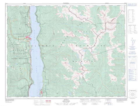
082F15 Kaslo Canada topo map, 1:50,000 scale
082F15 Kaslo NRCAN topographic map.
Includes UTM and GPS geographic coordinates (latitude and longitude). This 50k scale map is suitable for hiking, camping, and exploring, or you could frame it as a wall map.
Printed on-demand using high resolution, on heavy weight and acid free paper, or as an upgrade on a variety of synthetic materials.
Topos available on paper, Waterproof, Poly, or Tyvek. Usually shipping rolled, unless combined with other folded maps in one order.
- Product Number: NRCAN-082F15
- Parent Topo: TOPO-082F
- Map ID also known as: 082F15, 82F15
- Unfolded Size: Approximately 26" high by 36" wide
- Weight (paper map): ca. 55 grams
- Map Type: POD NRCAN Topographic Map
- Map Scale: 1:50,000
- Geographical region: British Columbia, Canada
Neighboring Maps:
All neighboring Canadian topo maps are available for sale online at 1:50,000 scale.
Purchase the smaller scale map covering this area: Topo-082F
Spatial coverage:
Topo map sheet 082F15 Kaslo covers the following places:
- Campbell Bay - Galena Bay - Kaslo Bay - Silver Bay - Beauty Beach - Maynard Point - Verandah Point - Woodbury Point - Clute Lake - Fletcher Lake - Josephine Lake - Kootenay Lake - Leviathan Lake - Mirror Lake - Plaid Lake - Armour Peak - Bivouac Tower - Block Tower - Blue Ridge - Bluebell Mountain - Columbia Mountains - Devil's Horn - Eagle Crest - Goat Range - Hall Peak - Kokanee Range - Leaning Towers - Mount Baldr - Mount Buchanan - Mount Gill - Mount Kaslo - Mount Loki - Powderkeg Peak - Purcell Mountains - Selkirk Mountains - Sharks Head Tower - True Blue Mountain - Wall Tower - Regional District of East Kootenay - Kootenay Lake Park - Kootenay Lake Recreation Area - Purcell Wilderness Conservancy - Bernard Creek - Bjerkness Creek - Calamity Creek - Campbell Creek - Cedar Creek - Clute Creek - Coppery Creek - Crystal Creek - Dewar Creek - Fletcher Creek - Gillis Creek - Goldsmith Creek - Hendryx Creek - Indian Creek - Kaslo River - Keen Creek - Kemball Creek - Kemp Creek - Lapointe Creek - Leet Creek - Lendrum Creek - Loki Creek - Milford Creek - Murphy Creek - Office Creek - Pinnacle Creek - Powder Creek - Princess Creek - Sawyer Creek - Seven Mile Creek - Shutty Creek - St. Mary River - Tam O'Shanter Creek - White Creek - Wing Creek - Woodbury Creek - Mirror Lake - Riondel - Shutty Bench - Woodberry - Zwicky - Rose Pass - Kaslo


