
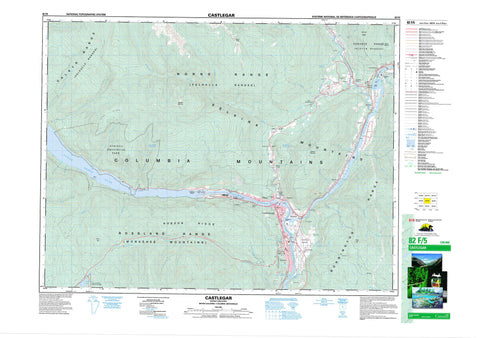
082F05 Castlegar Canada topo map, 1:50,000 scale
082F05 Castlegar NRCAN topographic map.
Includes UTM and GPS geographic coordinates (latitude and longitude). This 50k scale map is suitable for hiking, camping, and exploring, or you could frame it as a wall map.
Printed on-demand using high resolution, on heavy weight and acid free paper, or as an upgrade on a variety of synthetic materials.
Topos available on paper, Waterproof, Poly, or Tyvek. Usually shipping rolled, unless combined with other folded maps in one order.
- Product Number: NRCAN-082F05
- Parent Topo: TOPO-082F
- Map ID also known as: 082F05, 82F5, 82F05
- Unfolded Size: Approximately 26" high by 36" wide
- Weight (paper map): ca. 55 grams
- Map Type: POD NRCAN Topographic Map
- Map Scale: 1:50,000
- Geographical region: British Columbia, Canada
Neighboring Maps:
All neighboring Canadian topo maps are available for sale online at 1:50,000 scale.
Purchase the smaller scale map covering this area: Topo-082F
Spatial coverage:
Topo map sheet 082F05 Castlegar covers the following places:
- Sandy Bay - Wards Bay - Driftwood Beach - Purdys Point - Shields Point - Castlegar - Hugh Keenleyside Dam - Neekas Indian Reserve 4 - Gold Island - Zuckerberg Island - Langill Lake - Lower Arrow Lake - Nancy Greene Lake - Sheep Lake - Aaron Hill - Bentz Peak - Bonnington Range - Columbia Mountains - Gem Hill - Kokanee Range - Ladybird Mountain - Monashee Mountains - Mount Stewart - Norns Mountains - Norns Range - Pine Ridge - Robson Ridge - Rossland Range - Selkirk Mountains - Sentinel Mountain - Slocan Ranges - Slocan Ridge - Valhalla Mountains - Valhalla Range - Valhalla Ranges - Valkyr Mountains - Valkyr Range - Brilliant Terrace Park - Nancy Greene Park - Pass Creek Park - Syringa Creek Park - Syringa Park - Andersons Flats - Slocan Pool - Tincup Rapids - Waterloo Eddy - Airport Creek - Allandale Creek - Bear Creek - Beet Creek - Blueberry Creek - Brodie Creek - Cai Creek - Cant Creek - Cayuse Creek - Champion Creek - Columbia River - Cub Creek - Davidson Brook - Durham Creek - Ezra Creek - Falls Creek - Farr Creek - Fleuve Columbia - Gander Creek - Gibson Creek - Glade Creek - Goose Creek - Hood Creek - Iron Creek - Jacob Creek - Judkin Creek - Kinney Creek - Kootenay River - Ladybird Creek - Langill Creek - Little Cayuse Creek - Little McPhee Creek - McCormick Creek - McDermid Creek - McPhee Creek - Merry Creek - Moberly Creek - Norns Creek - Ootischenia Creek - Phillips Creek - Rialto Creek - Rover Creek - Schofield Creek - Sher Creek - Shields Creek - Slocan River - Smoky Creek - Syringa Creek - Tarrys Creek - Tulip Creek - Wolverton Creek - Yarrow Creek - Skattebo Reach - Allandale - Brilliant - Crescent Valley - Fraine - Gibson Creek - Glade - Kinnaird - Koseanices Spur - Kraft - Krestova - Labarthe - New Settlement - Ootischenia - Ootishenia - Pass Creek - Playmor Junction - Raspberry - Robson - Robson West - Shields - Shoreacres - South Slocan - Syringa Creek - Tarrys - Thrums - Westley - Pass Valley


