
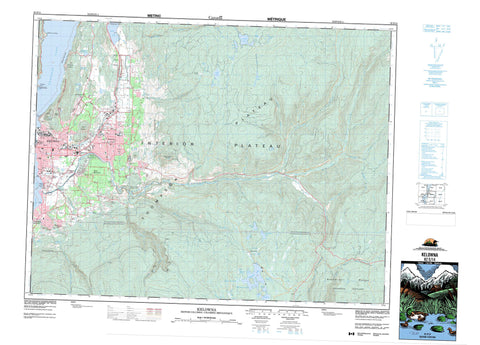
082E14 Kelowna Canada topo map, 1:50,000 scale
082E14 Kelowna NRCAN topographic map.
Includes UTM and GPS geographic coordinates (latitude and longitude). This 50k scale map is suitable for hiking, camping, and exploring, or you could frame it as a wall map.
Printed on-demand using high resolution, on heavy weight and acid free paper, or as an upgrade on a variety of synthetic materials.
Topos available on paper, Waterproof, Poly, or Tyvek. Usually shipping rolled, unless combined with other folded maps in one order.
- Product Number: NRCAN-082E14
- Parent Topo: TOPO-082E
- Map ID also known as: 082E14, 82E14
- Unfolded Size: Approximately 26" high by 36" wide
- Weight (paper map): ca. 55 grams
- Map Type: POD NRCAN Topographic Map
- Map Scale: 1:50,000
- Geographical region: British Columbia, Canada
Neighboring Maps:
All neighboring Canadian topo maps are available for sale online at 1:50,000 scale.
Purchase the smaller scale map covering this area: Topo-082E
Spatial coverage:
Topo map sheet 082E14 Kelowna covers the following places:
- Traders Cove - Poplar Point - Kelowna - Osoyoos Division Yale Land District - Similkameen Division Yale Land District - Duck Lake Indian Reserve 7 - Medicine Creek 12 - Medicine Hill 11 - Mission Creek Indian Reserve 8 - Réserve indienne Duck Lake 7 - Réserve indienne Mission Creek 8 - Alkali Lake - Alki Lake - Browne Lake - Carney Pond - Duck Lake - Ellison Lake - Ern Lake - Fish Lake - Frazer Lake - Geen Lake - Geen Lakes - Guest Lake - Haynes Lake - Hereron Lake - Hydraulic Lake - Jack Smith Lake - James Lake - Knox Lake - Lightblue Lake - Lodge Lake - Long Meadow Lake - Lynx Lake - McCulloch Reservoir - McKinley Reservoir - Meadow Lake - Minnow Lake - Mission Slough - Okanagan Lake - Pear Lake - Postill Lake - Robert Lake - Rodney Lake - South Lake - Summit Lake - Turtle Lake - Walroy Lake - Waterlily Lake - Weddell Lake - Beaverdell Range - Black Knight Mountain - Mine Hill - Mount Dilworth - Mount Knox - Okanagan Highland - Regional District of Central Okanagan - Regional District of Kootenay-Boundary - Guisachan - Mission Beach Park - Sutherland Hills Park - Interior Plateau - Thompson Plateau - Belgo Creek - Bellevue Creek - Bolton Creek - Brandt Creek - Campin Creek - Cardinal Creek - Clark Creek - Darley Creek - Daves Creek - Dilworth Creek - Emery Creek - Fascieux Creek - Foolhen Creek - Gillard Creek - Grouse Creek - Guest Creek - Hachey Creek - Hardy Creek - Hydraulic Creek - James Creek - Jennie Creek - Joe Rich Creek - Kallis Creek - Kelowna Creek - Klo Creek - Knox Creek - Leech Creek - Mill Creek - Mission Creek - Morrison Creek - Mugford Creek - Myra Creek - Pearson Creek - Pooley Creek - Prather Creek - Priest Creek - Rembler Creek - Rockface Creek - Rumohr Creek - Schram Creek - Scotty Creek - Sidede Creek - Tress Creek - Victor Creek - West Kettle River - Westkettle River - Whelan Creek - Benvoulin - East Kelowna - Ellison - Lorna - McCulloch - McKinley Landing - Myra - Okanagan Mission - Postill - Ruth - Rutland - Traders Cove - Wilson Landing - Orchard Meadows


