
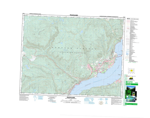
082E13 Peachland Canada topo map, 1:50,000 scale
082E13 Peachland NRCAN topographic map.
Includes UTM and GPS geographic coordinates (latitude and longitude). This 50k scale map is suitable for hiking, camping, and exploring, or you could frame it as a wall map.
Printed on-demand using high resolution, on heavy weight and acid free paper, or as an upgrade on a variety of synthetic materials.
Topos available on paper, Waterproof, Poly, or Tyvek. Usually shipping rolled, unless combined with other folded maps in one order.
- Product Number: NRCAN-082E13
- Parent Topo: TOPO-082E
- Map ID also known as: 082E13, 82E13
- Unfolded Size: Approximately 26" high by 36" wide
- Weight (paper map): ca. 55 grams
- Map Type: POD NRCAN Topographic Map
- Map Scale: 1:50,000
- Geographical region: British Columbia, Canada
Neighboring Maps:
All neighboring Canadian topo maps are available for sale online at 1:50,000 scale.
Purchase the smaller scale map covering this area: Topo-082E
Spatial coverage:
Topo map sheet 082E13 Peachland covers the following places:
- Green Bay - Pincushion Bay - Boucheries Point - Halfway Point - Manhattan Point - Siwash Point - Kelowna - District of West Kelowna - Peachland - Westside - Kamloops Division Yale Land District - Osoyoos Division Yale Land District - Similkameen Division Yale Land District - Réserve indienne Tsinstikeptum 10 - Réserve indienne Tsinstikeptum 9 - Tsinstikeptum Indian Reserve 10 - Tsinstikeptum Indian Reserve 9 - Art Pond - Banana Lake - Cameo Lake - Cameron Lake - Dobbin Lake - Eneas Lakes - George Lake - Glen Lake - Hayman Lake - Headwater Lakes - Islaht Lake - Island Lake - Jackpine Lake - Lacoma Lake - Lambly Lake - Lily Lake - Little Eneas Lake - Little Windy Lake - Long Lake - McCall Lakes - Okanagan Lake - Paynter Lake - Peachland Lake - Porcupine Lake - Raymer Lake - Rose Valley Lake - Shannon Lake - Silver Lake - Spring Lake - Tsuh Lake - Webber Lake - West Lake - Wilson Lake - Windy Lake - Blue Grouse Mountain - Bouchier Mountain - Carrot Mountain - Lookout Mountain - Mount Boucherie - Mount Clements - Mount Coldham - Mount Drought - Mount Gottfriedsen - Mount Hayman - Mount Last - Mount Law - Mount Miller - Mount Swite - Mount Wilson - Pincushion Mountain - Regional District of Central Kootenay - Regional District of Central Okanagan - Bear Creek Park - Eneas Lakes Park - Kalamoir Park - Okanagan Mountain Park - Westbank Park - Interior Plateau - Thompson Plateau - Crystal Mountain - Ashley Creek - Bald Range Creek - Banana Creek - Bellevue Creek - Bertram Creek - Bit Creek - Blue Grouse Creek - Bolingbroke Creek - Bolivar Creek - Bowen Creek - Clover Creek - Davidson Creek - Deeper Creek - Deland Creek - Drought Creek - Faulkner Creek - Finlay Creek - George Creek - Greata Creek - Harding Creek - Hayman Creek - Hidden Creek - Hill Creek - Jack Creek - Jennie Creek - John Moore Creek - Keefe Creek - Kelowna Creek - Lacoma Creek - Lambly Creek - Law Creek - Lebanon Creek - MacDonald Creek - McCall Creek - McDougall Creek - Mile Creek - North Lambly Creek - North Powers Creek - Peachland Creek - Pigeon Creek - Powers Creek - Reil Creek - Rembler Creek - Reservoir Creek - Scroggins Creek - Second Creek - Silver Creek - Smith Creek - Snowsell Creek - Stony Creek - Sweid Creek - Terrace Creek - Tomat Creek - Trépanier Creek - Trout Creek - Varty Creek - Venner Creek - Walker Creek - Westbank Creek - Braeloch - Gellatly - Glenrosa - Lakeview Heights - Okanagan Mission - Traders Cove - Trépanier - Westbank - Westside - Wild Horse Canyon - Wilson Gulch


