
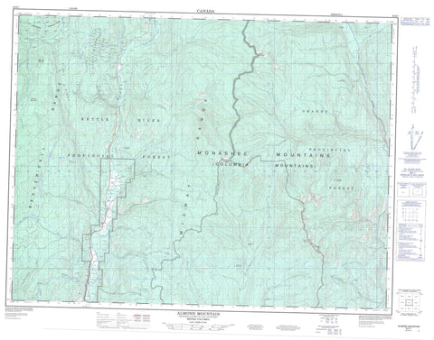
082E07 Almond Mountain Canada topo map, 1:50,000 scale
082E07 Almond Mountain NRCAN topographic map.
Includes UTM and GPS geographic coordinates (latitude and longitude). This 50k scale map is suitable for hiking, camping, and exploring, or you could frame it as a wall map.
Printed on-demand using high resolution, on heavy weight and acid free paper, or as an upgrade on a variety of synthetic materials.
Topos available on paper, Waterproof, Poly, or Tyvek. Usually shipping rolled, unless combined with other folded maps in one order.
- Product Number: NRCAN-082E07
- Parent Topo: TOPO-082E
- Map ID also known as: 082E07, 82E7, 82E07
- Unfolded Size: Approximately 26" high by 36" wide
- Weight (paper map): ca. 55 grams
- Map Type: POD NRCAN Topographic Map
- Map Scale: 1:50,000
- Geographical region: British Columbia, Canada
Neighboring Maps:
All neighboring Canadian topo maps are available for sale online at 1:50,000 scale.
Purchase the smaller scale map covering this area: Topo-082E
Spatial coverage:
Topo map sheet 082E07 Almond Mountain covers the following places:
- Hoodoo Lake - Taurus Lake - Thone Lake - Triple Lakes - Williamson Lake - Almond Mountain - Beaverdell Range - Christina Range - Columbia Mountains - Crystal Butte - Crystal Mountain - Gable Mountain - Kloof Ridge - Lake Ridge - Midway Mountains - Midway Range - Monashee Mountains - Mosher Ridge - Mount Mitchell - Mount Wallace - Okanagan Highland - St. John Ridge - Terraced Peak - Regional District of Central Kootenay - Regional District of Kootenay-Boundary - Interior Plateau - Almond Creek - Avenzor Creek - Beaverdell Creek - Blythe Creek - Boomerang Creek - Bosshart Creek - Boundary Creek - Boyer Creek - Canyon Creek - Carmi Creek - Christensen Creek - Crick Creek - Crouse Creek - Crystal Creek - David Creek - Dear Creek - Fourth of July Creek - Gable Creek - Gibbs Creek - Granby River - Gutteridge Creek - Guttridge Creek - Hay Creek - Henderson Creek - Howe Creek - Kennedy Creek - Kettle River - Larsen Creek - Little Creek - Lost Horse Creek - Mosher Creek - Mulligan Creek - Ouellette Creek - Paturages Creek - Sebastian Creek - Spout Creek - Steeves Creek - Stewartson Creek - Taurus Creek - Thone Creek - Waddell Creek - Wasmes Creek - Wildhorse Creek - Williamson Creek


