
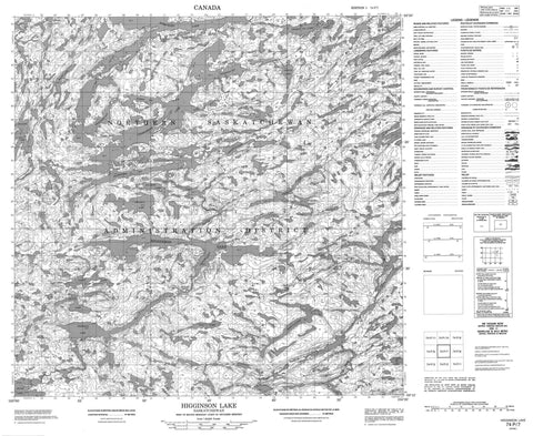
074P07 Higginson Lake Canada topo map, 1:50,000 scale
074P07 Higginson Lake NRCAN topographic map.
Includes UTM and GPS geographic coordinates (latitude and longitude). This 50k scale map is suitable for hiking, camping, and exploring, or you could frame it as a wall map.
Printed on-demand using high resolution, on heavy weight and acid free paper, or as an upgrade on a variety of synthetic materials.
Topos available on paper, Waterproof, Poly, or Tyvek. Usually shipping rolled, unless combined with other folded maps in one order.
- Product Number: NRCAN-074P07
- Parent Topo: TOPO-074P
- Map ID also known as: 074P07, 74P7, 74P07
- Unfolded Size: Approximately 26" high by 36" wide
- Weight (paper map): ca. 55 grams
- Map Type: POD NRCAN Topographic Map
- Map Scale: 1:50,000
- Geographical region: Saskatchewan, Canada
Neighboring Maps:
All neighboring Canadian topo maps are available for sale online at 1:50,000 scale.
Purchase the smaller scale map covering this area: Topo-074P
Spatial coverage:
Topo map sheet 074P07 Higginson Lake covers the following places:
- Ashworth Bay - Dramnitzke Bay - Forbes Bay - Graham Bay - Harrison Bay - Kyle Bay - Graham Rapids - Acton Lake - Balliet Lake - Black Lake - Chaban Lake - Charlebois Lake - Chestnut Lake - Guppy Lake - Hauff Lake - Heisler Lake - Henry Lake - Higginson Lake - Jervois Lake - Laidlaw Lake - Leniuk Lake - Machete Lake - Maxmen Lake - Okemasis Lake - Ott Lake - Paisley Lake - Pegasus Lake - Peterson Lake - Phoenix Lake - Scarcy Lake - Sparling Lake - Spreckley Lake - Tull Lake - Tycoles Lake - Walland Lake - Wing Lake - Porcupine River - Souter River


