
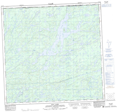
074N16 Ena Lake Canada topo map, 1:50,000 scale
074N16 Ena Lake NRCAN topographic map.
Includes UTM and GPS geographic coordinates (latitude and longitude). This 50k scale map is suitable for hiking, camping, and exploring, or you could frame it as a wall map.
Printed on-demand using high resolution, on heavy weight and acid free paper, or as an upgrade on a variety of synthetic materials.
Topos available on paper, Waterproof, Poly, or Tyvek. Usually shipping rolled, unless combined with other folded maps in one order.
- Product Number: NRCAN-074N16
- Parent Topo: TOPO-074N
- Map ID also known as: 074N16, 74N16
- Unfolded Size: Approximately 26" high by 36" wide
- Weight (paper map): ca. 55 grams
- Map Type: POD NRCAN Topographic Map
- Map Scale: 1:50,000
- Geographical region: Saskatchewan, Canada
Neighboring Maps:
All neighboring Canadian topo maps are available for sale online at 1:50,000 scale.
Purchase the smaller scale map covering this area: Topo-074N
Spatial coverage:
Topo map sheet 074N16 Ena Lake covers the following places:
- Davidson Bay - Lakena Bay - Nadir Bay - Scott Bay - Peters Falls - Gillis Island - Scott Island - Bayliss Lake - Bogue Lake - Bulmer Lake - Capraru Lake - Charlot Lake - Corman Lake - Dezall Lake - Drake Lake - Dusyk Lake - Ena Lake - Fast Lake - Garner Lake - Grant Lake - Greensky Lake - Hicks Lake - Keyes Lake - Linnell Lake - Litowski Lake - Little Lake - Mackey Lake - McCue Lake - McGrath Lake - McNutt Lake - Nisbet Lake - Proudlock Lake - Proudlock Lake - Quickfall Lake - Senton Lake - Senton Lake - Shorten Lake - Stretching Lakes - Veregin Lake - Martin Rapids - Allansmith River - Ena River - Ena River - Tazin River - Tazin River


