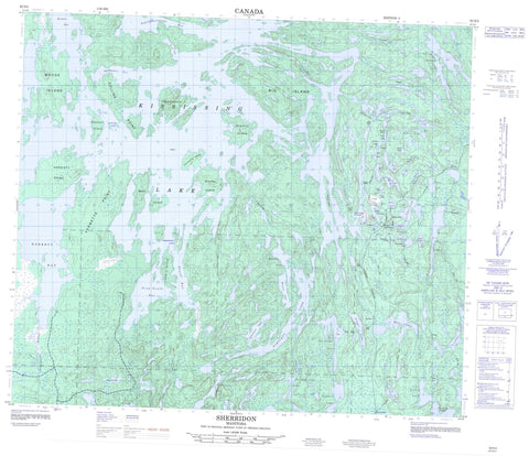
063N03 Sherridon Canada topo map, 1:50,000 scale
063N03 Sherridon NRCAN topographic map.
Includes UTM and GPS geographic coordinates (latitude and longitude). This 50k scale map is suitable for hiking, camping, and exploring, or you could frame it as a wall map.
Printed on-demand using high resolution, on heavy weight and acid free paper, or as an upgrade on a variety of synthetic materials.
Topos available on paper, Waterproof, Poly, or Tyvek. Usually shipping rolled, unless combined with other folded maps in one order.
- Product Number: NRCAN-063N03
- Parent Topo: TOPO-063N
- Map ID also known as: 063N03, 63N3, 63N03
- Unfolded Size: Approximately 26" high by 36" wide
- Weight (paper map): ca. 55 grams
- Map Type: POD NRCAN Topographic Map
- Map Scale: 1:50,000
- Geographical region: Manitoba, Canada
Neighboring Maps:
All neighboring Canadian topo maps are available for sale online at 1:50,000 scale.
Purchase the smaller scale map covering this area: Topo-063N
Spatial coverage:
Topo map sheet 063N03 Sherridon covers the following places:
- Aikenhead Bay - Aikenhead Bay - Barrett Bay - Burkes Bay - Deep South Bay - Home Bay - McCurlys Bay - McKenzie Bay - Moose Mouth Bay - Nestors Bay - Park Bay - Reds Bay - Snow Bay - South Bay - Teasdale Bay - Tukikumewseepi Bay - Wilsie Bay - Collins Point - Devils Point - Drummonds Point - Hardisty Point - Spruce Point - Vermette Point - Cooks Narrows - Devils Narrows - Pickerel Narrows - Russick Narrows - Sawmill Narrows - Trout Narrows - Belyea Island - Big Island - Dawson Island - Dearle Island - DuBouvier Island - Fire Ranger Island - Groves Island - Hudson Bay Island - Moor Island - Moose Island - Porcupine Island - Range Island - Sasayskikwan Island - Sherlett Island - Sherritt Island - Yakushavich Island - Adamson Lake - Archie Lake - Barr Lake - Bartlett Lake - Bay Lake - Bess Lake - Bob Lake - Camp Lake - Cleunion Lake - Club Lake - Contact Lake - Cree Lake - Don Lake - Duke Lake - Dumbell Lake - Finger Lake - Found Lake - Fox Lake - Gwillam Lake - Jackpine Lake - Jay Lake - Jonah Lake - Kaniak Lake - Ken Lake - Kiki Lake - Kississing Lake - Lilyroot Lake - Lost Lake - Maltman Lake - Minnow Lake - Molly Lake - Narrows Lake - Park Lake - Piat Lake - Ponton Lake - Portage Lake - Premier Lake - Ptarmigan Lake - Sheila Lake - Sherlett Lake - Singsing Lake - South Loon Lake - Tap Lake - Three Finger Lake - Thunderhill Lake - Transit Lake - Trap Lake - Twinbay Lake - Wood Lake - Beaucage Creek - Bess Creek - Kississing River - Sherlett Creek - Red Rock - Cold Lake - Fay Lake - Kississing - Sherridon


