
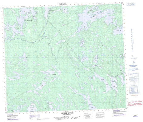
063M08 Nemei Lake Canada topo map, 1:50,000 scale
063M08 Nemei Lake NRCAN topographic map.
Includes UTM and GPS geographic coordinates (latitude and longitude). This 50k scale map is suitable for hiking, camping, and exploring, or you could frame it as a wall map.
Printed on-demand using high resolution, on heavy weight and acid free paper, or as an upgrade on a variety of synthetic materials.
Topos available on paper, Waterproof, Poly, or Tyvek. Usually shipping rolled, unless combined with other folded maps in one order.
- Product Number: NRCAN-063M08
- Parent Topo: TOPO-063M
- Map ID also known as: 063M08, 63M8, 63M08
- Unfolded Size: Approximately 26" high by 36" wide
- Weight (paper map): ca. 55 grams
- Map Type: POD NRCAN Topographic Map
- Map Scale: 1:50,000
- Geographical region: Saskatchewan, Canada
Neighboring Maps:
All neighboring Canadian topo maps are available for sale online at 1:50,000 scale.
Purchase the smaller scale map covering this area: Topo-063M
Spatial coverage:
Topo map sheet 063M08 Nemei Lake covers the following places:
- Clark Bay - Johnson Bay - Ward Bay - Jones Peninsula - Hewitt Narrows - Wilson Falls - Kipahigan Sakahikan 222 - Nemekus Sakahikan 221 - Sokatisewin Sakahikan 224 - Waskwiatik Sakahikan 223 - Bell Island - Campbell Island - Charbonneau Island - Collins Island - Lechowicz Island - Belcher Lake - Chomyn Lake - Fish Lake - Golden Lake - Harper Lake - Huber Lake - Jones Lake - Kipahigan Lake - MacLean Lake - Mari Lake - Mason Lake - McArthur Lake - Nemei Lake - Oskotim Lake - Ouellette Lake - Phelan Lake - Robbestad Lake - Sokatisewin Lake - Tocher Lake - Tyrer Lakes - Wasawakasik Lake - Wuskwiatik Lake - Churchill River - Nemei River - Rivière Churchill


