
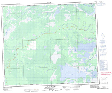
063E15 Old Channel Canada topo map, 1:50,000 scale
063E15 Old Channel NRCAN topographic map.
Includes UTM and GPS geographic coordinates (latitude and longitude). This 50k scale map is suitable for hiking, camping, and exploring, or you could frame it as a wall map.
Printed on-demand using high resolution, on heavy weight and acid free paper, or as an upgrade on a variety of synthetic materials.
Topos available on paper, Waterproof, Poly, or Tyvek. Usually shipping rolled, unless combined with other folded maps in one order.
- Product Number: NRCAN-063E15
- Parent Topo: TOPO-063E
- Map ID also known as: 063E15, 63E15
- Unfolded Size: Approximately 26" high by 36" wide
- Weight (paper map): ca. 55 grams
- Map Type: POD NRCAN Topographic Map
- Map Scale: 1:50,000
- Geographical region: Saskatchewan, Canada
Neighboring Maps:
All neighboring Canadian topo maps are available for sale online at 1:50,000 scale.
Purchase the smaller scale map covering this area: Topo-063E
Spatial coverage:
Topo map sheet 063E15 Old Channel covers the following places:
- Brown Bay - Dinner Point - Cadotte Channel - Dragline Channel - New Channel - Old Channel - Ratroot Channel - Sipanok Channel - Steamboat Channel - Budd Island - Pine Island - Bloodsucker Lake - Brown Lake - Cook Lake - Cow Lake - Cut Beaver Lake - Deep Lake - Dumbell Lake - Grassy Lake - Moose Jaw Lake - Muskeg Lakes - Paul Lake - Wapisew Lake - Dragline Channel Recreation Site - Bloodsucker Creek - Centre Angling River - Cut Beaver River - Mink Creek - North Angling River - Rivière Saskatchewan - Saskatchewan River - South Angling River - Zig Zag Creek


