
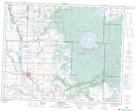
062N12 Kamsack Canada topo map, 1:50,000 scale
062N12 Kamsack NRCAN topographic map.
Includes UTM and GPS geographic coordinates (latitude and longitude). This 50k scale map is suitable for hiking, camping, and exploring, or you could frame it as a wall map.
Printed on-demand using high resolution, on heavy weight and acid free paper, or as an upgrade on a variety of synthetic materials.
Topos available on paper, Waterproof, Poly, or Tyvek. Usually shipping rolled, unless combined with other folded maps in one order.
- Product Number: NRCAN-062N12
- Parent Topo: TOPO-062N
- Map ID also known as: 062N12, 62N12
- Unfolded Size: Approximately 26" high by 36" wide
- Weight (paper map): ca. 55 grams
- Map Type: POD NRCAN Topographic Map
- Map Scale: 1:50,000
- Geographical region: Manitoba, Canada
Neighboring Maps:
All neighboring Canadian topo maps are available for sale online at 1:50,000 scale.
Purchase the smaller scale map covering this area: Topo-062N
Spatial coverage:
Topo map sheet 062N12 Kamsack covers the following places:
- East Bay - Pelly Bay - Benito Beach - Jubilee Beach - Kamsack Beach - Ministik Beach - Cote 64 - Keeseekoose 66 - Keeseekoose 66-St-02 - Keeseekoose 66-St-03 - Keeseekoose Kk 66-ST-04 - Miles Island - Agnes Lake - Batka Lake - Batka Lake - Bear Head Lake - Bear Head Lake - Benson Lake - Bird Lake - Bonus Lake - Boomerang Lake - Borland Lake - Carmichael Lake - Chernoff Lake - Crowfoot Lake - Cucumber Lake - Dell Lake - Dry Meadow Lake - Green Lake - Harold Lake - Jackfish Lake - Ketchamonia Lake - Ketchemonia Lake - Kihi Lake - Kipp Lake - Kipp Lake - Lamb Lake - Lang Lake - Lilley Lake - Madge Lake - Mona Lake - Moose Lake - Nash Lake - Roe Lake - Roper Lake - Rotten Lake - Rundle Lake - Seargeant Lake - Selwood Lake - Sergeant Lake - Slip Lake - Smith Lake - Spruce Lake - Twill Lake - Yellow Lake - Duck Mountain - Duck Mountain - Cote No. 271 - St. Philips No. 301 - Swan River - Duck Mountain Provincial Forest - Duck Mountain Provincial Forest - Duck Mountain Provincial Park - Duck Mountain Provincial Park - Duck Mountain Regional Park - Assiniboine River - Assiniboine River - Bear Head Creek - Bear Head Creek - Big Boggy Creek - Big Boggy Creek - Clearwater Creek - Kamsack Creek - Little Boggy Creek - Little Boggy Creek - North Two Creek - South Two Creek - Watts Creek - Whitesand River - Kamsack - Badgerville - Coté - Hillside - Kamsack Beach - Ministik Beach - Springside - St. Philips


