
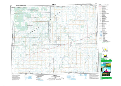
062L14 Lorlie Canada topo map, 1:50,000 scale
062L14 Lorlie NRCAN topographic map.
Includes UTM and GPS geographic coordinates (latitude and longitude). This 50k scale map is suitable for hiking, camping, and exploring, or you could frame it as a wall map.
Printed on-demand using high resolution, on heavy weight and acid free paper, or as an upgrade on a variety of synthetic materials.
Topos available on paper, Waterproof, Poly, or Tyvek. Usually shipping rolled, unless combined with other folded maps in one order.
- Product Number: NRCAN-062L14
- Parent Topo: TOPO-062L
- Map ID also known as: 062L14, 62L14
- Unfolded Size: Approximately 26" high by 36" wide
- Weight (paper map): ca. 55 grams
- Map Type: POD NRCAN Topographic Map
- Map Scale: 1:50,000
- Geographical region: Saskatchewan, Canada
Neighboring Maps:
All neighboring Canadian topo maps are available for sale online at 1:50,000 scale.
Purchase the smaller scale map covering this area: Topo-062L
Spatial coverage:
Topo map sheet 062L14 Lorlie covers the following places:
- Little Black Bear 84 - Okanese 82P - Okanese 82 - Okanese 82 (DD) - Okanese 82(BB) - Okanese 82(CC) - Okanese 82(EE) - Okanese 82(Q) - Okanese 82(R) - Okanese 82(T) - Okanese 82(U) - Okanese 82(V) - Okanese 82(W) - Okanese 82(Y) - Okanese 82(Z) - Okanese 82A - Okanese 82B - Okanese 82D - Okanese 82E - Okanese 82F - Okanese 82G - Okanese 82I - Okanese 82K - Okanese 82M - Okanese 82O - Peepeekisis 81 - Star Blanket 83 - Star Blanket 83-D - Star Blanket 83E - Star Blanket 83F - Star Blanket 83G - Star Blanket 83H - Star Blanket 83I - Star Blanket 83K - File Hills - Pheasant Hills - Abernethy No. 186 - McLeod No. 185 - Stanley No. 215 - Tullymet No. 216 - Duff Recreation Site - Touchwood Uplands - Kaposvar Creek - Pearl Creek - Pheasant Creek - Pheasant Forks Creek - Finnie - Gillespie - Lorlie - Pheasant Forks - Abernethy - Duff


