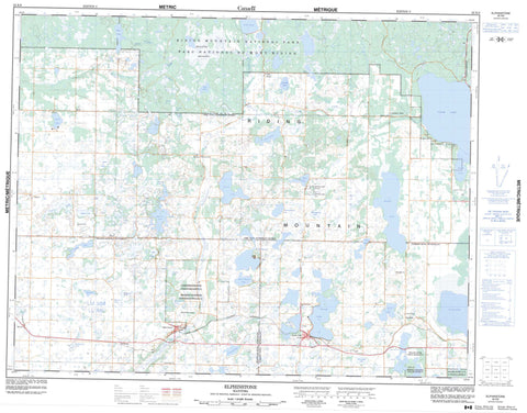
062K09 Elphinstone Canada topo map, 1:50,000 scale
062K09 Elphinstone NRCAN topographic map.
Includes UTM and GPS geographic coordinates (latitude and longitude). This 50k scale map is suitable for hiking, camping, and exploring, or you could frame it as a wall map.
Printed on-demand using high resolution, on heavy weight and acid free paper, or as an upgrade on a variety of synthetic materials.
Topos available on paper, Waterproof, Poly, or Tyvek. Usually shipping rolled, unless combined with other folded maps in one order.
- Product Number: NRCAN-062K09
- Parent Topo: TOPO-062K
- Map ID also known as: 062K09, 62K9, 62K09
- Unfolded Size: Approximately 26" high by 36" wide
- Weight (paper map): ca. 55 grams
- Map Type: POD NRCAN Topographic Map
- Map Scale: 1:50,000
- Geographical region: Manitoba, Canada
Neighboring Maps:
All neighboring Canadian topo maps are available for sale online at 1:50,000 scale.
Purchase the smaller scale map covering this area: Topo-062K
Spatial coverage:
Topo map sheet 062K09 Elphinstone covers the following places:
- Bottle Lake 61B - Keeseekoowenin 61 - Rolling River 67 - Archies Lake - Audy Lake - Battle Lake - Beauford Lake - Beaufort Lake - Birch Lake - Bone Lake - Bonhommes Lake - Bottle Lake - Chipple Lake - Chorney Lake - Christopherson Lake - Clear Lake - Corstorphine Lake - Crawford Lake - Czornyj Lake - Czwaluk Lake - Dummy Lake - Governors Lake - Groszok Lake - Gunville Lake - Horod Lake - Imrie Lake - Jackfish Lake - Labaij Lake - Lake Audy - McAllister Lake - McNaughten Lake - Moroz Lake - Morton Lake - Mossop Lake - Nest Lake - North Thomas Lake - Payne Lake - Pigeon Lake - Plewak Lake - Proven Lake - Puzzle Lake - Pybus Lake - Salt Lake - Sandy Lake - Second Lake - Seech Lake - Shewchuks Lake - Shwaluk Lake - Slater Lake - South Lake - South Thomas Lake - St. Dalmas Lake - Stadnyks Lake - Stuart Lake - Tenth Lake - Third Lake - Thomas Lake - Wargatie Lake - Williamsons Lake - Wolf Lake - Zeller Lake - Riding Mountain - Harrison - Park - Strathclair - Parc national du Canada du Mont-Riding - Proven Lake Wildlife Management Area - Riding Mountain National Park of Canada - Bone Creek - Clear Creek - Heron Creek - Jackfish Creek - Little Saskatchewan River - Minnedosa River - Oak River - Wasamin Creek - Crawford Park - Elphinstone - Glenforsa - Horod - Keeseekoowenin - Lake Audy - Menzie - Rackham - Rogers - Sandy Lake - Seech - Wisla - Moulton Meadows


