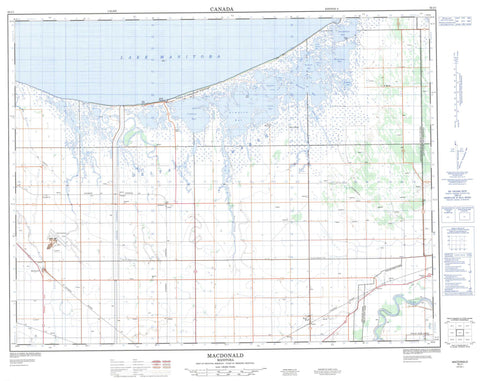
062J01 Macdonald Canada topo map, 1:50,000 scale
062J01 Macdonald NRCAN topographic map.
Includes UTM and GPS geographic coordinates (latitude and longitude). This 50k scale map is suitable for hiking, camping, and exploring, or you could frame it as a wall map.
Printed on-demand using high resolution, on heavy weight and acid free paper, or as an upgrade on a variety of synthetic materials.
Topos available on paper, Waterproof, Poly, or Tyvek. Usually shipping rolled, unless combined with other folded maps in one order.
- Product Number: NRCAN-062J01
- Parent Topo: TOPO-062J
- Map ID also known as: 062J01, 62J1, 62J01
- Unfolded Size: Approximately 26" high by 36" wide
- Weight (paper map): ca. 55 grams
- Map Type: POD NRCAN Topographic Map
- Map Scale: 1:50,000
- Geographical region: Manitoba, Canada
Neighboring Maps:
All neighboring Canadian topo maps are available for sale online at 1:50,000 scale.
Purchase the smaller scale map covering this area: Topo-062J
Spatial coverage:
Topo map sheet 062J01 Macdonald covers the following places:
- Aikens Bay - Bluebill Bay - Cadham Bay - Clandeboye Bay - Clandeboye Bay - Division Bay - Eaglenest Bay - First Bay - Forsters Bay - Gadwell Bay - Home Bay - Kitsons Bay - Lyttle Bay - Marsh Wren Bay - Portage Creek Bay - Richardsons Bay - Riley Bay - School Bay - School House Bay - Second Bay - Simpson Bay - Small Bluebill Bay - Thompsons Bay - Twenty Two Bay - Waterhen Bay - Westcan Bay - Bell Point - Cadham Point - Dog Point - Gillis Point - Greys Pass - Hefelfingers Point - North Stony Point - North Waterhen Point - Pitblados Point - Pointe à Cook - Porkchop Point - President Point - South Stony Point - South Waterhen Point - Delta Channel - Goldeye Pass - Hextalls Pass - Lavallee Pass - Lavallée Pass - Lavelle Pass - Peacocks Pass - Sioux Pass - The Gap - The Narrows - Oxbow Woods - High Bluff - Poplar Point - Arona Drain - Long Lake Drain - Mount Pleasant Drain - Portage Diversion - Rignold Drain - Flee Island - Lost Tooth Island - Big Lake - Blackfox Lake - Bone Pile Pothole - Chief Lake - Clair Lake - Crescent Pond - Dog Lake - Goldeye Pond - Halmarsons Pothole - High Bluff Lake - Horseshoe Pond - Jackfish Pond - Johnson Lake - Lac Manitoba - Lake Manitoba - Lake Merganser - McLean Lake - Richardsons Potholes - Salt Pond - St. Marks Lake - Sushawap Lake - Twin Lakes - Wilson Lake - Portage la Prairie - Delta Game Bird Refuge - St. Ambroise Game Bird Refuge - Assiniboine River - Blind Channel - Blue Ribbon Creek - Cook Creek - Cooks Creek - Cram Creek - Deep Creek - Eaglenest Creek - Fish Creek - Flee Island Creek - Frenchman Creek - House Creek - Image Creek - Lavallee Creek - Lavallée Creek - Lavelle Creek - Long Creek - Mill Creek - Mink Creek - Perch Creek - Portage Creek - Rat Creek - Rat Creek - Robertson Creek - Short Creek - The Long Arm - Waterhen Creek - West Deep Creek - Williams Creek - Willow Bend Creek - Willowbend Creek - Alpha - Delta Beach - Dundonald - Flee Island - Fulton - Genest - High Bluff - Longburn - Macdonald - Oakland - St. Marks - Tin Town - Townline - Dans Slough - Decoy Marsh - Delta Marsh - Flynns Slough - Johnsons Marsh - Lairds Slough - Richies Slough - Sharps Slough - Sioux Pass Marsh


