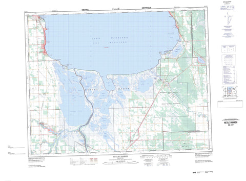
062I07 Netley Marsh Canada topo map, 1:50,000 scale
062I07 Netley Marsh NRCAN topographic map.
Includes UTM and GPS geographic coordinates (latitude and longitude). This 50k scale map is suitable for hiking, camping, and exploring, or you could frame it as a wall map.
Printed on-demand using high resolution, on heavy weight and acid free paper, or as an upgrade on a variety of synthetic materials.
Topos available on paper, Waterproof, Poly, or Tyvek. Usually shipping rolled, unless combined with other folded maps in one order.
- Product Number: NRCAN-062I07
- Parent Topo: TOPO-062I
- Map ID also known as: 062I07, 62I7, 62I07
- Unfolded Size: Approximately 26" high by 36" wide
- Weight (paper map): ca. 55 grams
- Map Type: POD NRCAN Topographic Map
- Map Scale: 1:50,000
- Geographical region: Manitoba, Canada
Neighboring Maps:
All neighboring Canadian topo maps are available for sale online at 1:50,000 scale.
Purchase the smaller scale map covering this area: Topo-062I
Spatial coverage:
Topo map sheet 062I07 Netley Marsh covers the following places:
- Balsam Bay - Pruden Bay - Beaconia Beach - Dunnottar Point - Sandy Point - Stephenson Point - Stoney Point - Whittles Point - Crooked Creek - Cross Channel - Cross River - East Channel - West Channel - St. Peters - Bruneau Drain - Fisher Drain - Whiskey Ditch - Brokenhead 4 - Peguis 1D - Peguis 1E - Peguis 1F - Peguis 1G - St. Peters Fishing Station 1A - Anderson Lake - Beaconia Lake - Boyd Lake - Clandeboye Ponds - Cochrane Lake - Cooks Lake - Folster Lake - Goldeye Lake - Gull Lake - Hardman Lake - Hardman Lakes - Hardmans Lakes - Harper Lake - Hughes Lake - Lac Winnipeg - Lake Winnipeg - Longbottoms Lake - Lower Devil Lake - McKay Lake - Mink Lake - Morrison Lake - Netley Lake - Oak Point Lake - Parisen Lake - Parisian Lake - Parisien Lake - Passwa Lake - Poplar Point Lake - Ramsay Lake - Starr Lake - Sullivans Lake - Swedish Lake - Upper Devil Lake - Wheelers Lake - Whittles Lake - Balsam Bay Hill - Mars Sand Hills - Alexander - Brokenhead - St. Andrews - St. Clements - Mars Hill Wildlife Management Area - Netley Creek Provincial Park - Netley Marsh Game Bird Refuge - Patricia Beach Provincial Park - Patricia Beach Provincial Recreation Park - Winnipeg Beach Provincial Park - Winnipeg Beach Provincial Recreation Park - Anderson Creek - Brokenhead River - Cochrane Creek - Cooks Creek - Devil Creek - Devils Creek - Goldeye Creek - Horseshoe Creek - Little Devil Creek - Main Channel - Marais Creek - Maria Creek - McKay Creek - Medicine Creek - Mink Creek - Muckle Creek - Netley Creek - Oak Point Creek - Passwa Creek - Pruden Creek - Red River - Rivière Brokenhead - Rivière Rouge - Salamonia Channel - Straight Creek - Sullivans Creek - Swedish Creek - Triple Creek - Tugela Creek - Wavey Creek - La Vérendrye Trail - Winnipeg Beach - Almdals Cove - Balsam Bay - Balsam Harbour - Beaconia - Breezy Point - Brokenhead Reserve - Chalet Beach - Gull Lake - Halcyon Cove - Island Beach - Lakeshore Heights - Libau - Matlock - Netley - Nettly Lake - Petersfield - Ponemah - Ponemah Beach - Poplar Park - Sans Souci - Sans Souci - Scanterbury - Sherwood - Whytewold - Netley Marsh - Dunnottar


