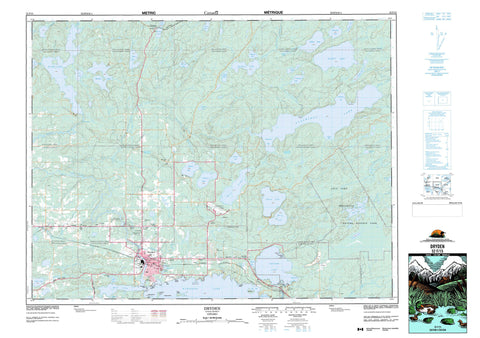
052F15 Dryden Canada topo map, 1:50,000 scale
052F15 Dryden NRCAN topographic map.
Includes UTM and GPS geographic coordinates (latitude and longitude). This 50k scale map is suitable for hiking, camping, and exploring, or you could frame it as a wall map.
Printed on-demand using high resolution, on heavy weight and acid free paper, or as an upgrade on a variety of synthetic materials.
Topos available on paper, Waterproof, Poly, or Tyvek. Usually shipping rolled, unless combined with other folded maps in one order.
- Product Number: NRCAN-052F15
- Parent Topo: TOPO-052F
- Map ID also known as: 052F15, 52F15
- Unfolded Size: Approximately 26" high by 36" wide
- Weight (paper map): ca. 55 grams
- Map Type: POD NRCAN Topographic Map
- Map Scale: 1:50,000
- Geographical region: Ontario, Canada
Neighboring Maps:
All neighboring Canadian topo maps are available for sale online at 1:50,000 scale.
Purchase the smaller scale map covering this area: Topo-052F
Spatial coverage:
Topo map sheet 052F15 Dryden covers the following places:
- Bonny Bay - Coates Bay - Elm Bay - Hoffstrom's Bay - Lindquist Bay - Lindstrom Bay - Mud Bay - Rutter's Bay - West Arm - Western Arm - Johnson's Beach - Sandy Beach - Clay Banks - Clay Banks - Cook's Point - Gullwing Point - Indian Point - McKay's Point - Mica Point - Parker's Point - Pronger's Point - Skillen's Point - Wood's Point - Dryden - Dryden Falls - Wainwright Falls - Aubrey - Breithaupt - Britton - Brownridge - Daniel - Drope - Eton - Hartman - Ladysmith - Laval - McIlraith - Rowell - Rugby - Stokes - Van Horne - Wainwright - Webb - Zealand - Anderson Island - Bridgewater's Island - Ledyard Island - Partridge Island - Picnic Island - Seagull Island - Stewart Island - Anaway Lake - Aubrey Lake - Banana Lake - Beartrack Lake - Beaver Lake - Bluett Lake - Broadtail Lake - Canard Lake - Coates Lake - Cook Lake - Fen Lake - Ghost Lake - Gilbert Lake - Good Lake - Gullwing Lake - Kaiashkomin Lake - Little Anaway Lake - Lola Lake - Lorne Lake - Loveland Lake - MacLean Lake - Marshall Lake - Mavis Lake - Milanese's Lakes - Nasen Lake - Needle Lake - Pronger Lake - Rafter Lake - Rice Lake - Rockbound Lake - Rugby Lake - Stafford Lake - Sunday Lake - Swanson Lake - Thunder Lake - Wabigoon Lake - Wickens Lake - Wildbull Lake - Zealand Lake - Barclay - Van Horne - Aaron Provincial Park - Airport Road Conservation Reserve - Lola Lake Provincial Nature Reserve - Pelican Rapids - Anaway Creek - Aubrey Creek - Beartrack Creek - Beaver Creek - Blackwater Creek - Bluett Creek - Gullwing Creek - Hughes Brook - Hughes Creek - Ladysmith Creek - McLeod's Creek - Pelican Creek - Rugby Creek - Shoshowae Creek - Swanson's Creek - Thunder Creek - Wabigoon River - Zealand Creek - Flat Rock - Barclay - Bedworth - Dryden - Earl Pit - Oxdrift - Richan - Six Mile Corner - Two Mile Corner


