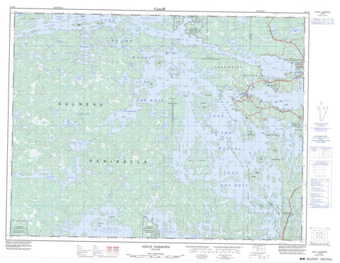
052E08 Sioux Narrows Canada topo map, 1:50,000 scale
052E08 Sioux Narrows NRCAN topographic map.
Includes UTM and GPS geographic coordinates (latitude and longitude). This 50k scale map is suitable for hiking, camping, and exploring, or you could frame it as a wall map.
Printed on-demand using high resolution, on heavy weight and acid free paper, or as an upgrade on a variety of synthetic materials.
Topos available on paper, Waterproof, Poly, or Tyvek. Usually shipping rolled, unless combined with other folded maps in one order.
- Product Number: NRCAN-052E08
- Parent Topo: TOPO-052E
- Map ID also known as: 052E08, 52E8, 52E08
- Unfolded Size: Approximately 26" high by 36" wide
- Weight (paper map): ca. 55 grams
- Map Type: POD NRCAN Topographic Map
- Map Scale: 1:50,000
- Geographical region: Ontario, Canada
Neighboring Maps:
All neighboring Canadian topo maps are available for sale online at 1:50,000 scale.
Purchase the smaller scale map covering this area: Topo-052E
Spatial coverage:
Topo map sheet 052E08 Sioux Narrows covers the following places:
- Blueberry Inlet - Boot Bay - Brûlé Bay - Camp Bay - Clipper Bay - Cloverleaf Bay - Cross Inlet - Devils Bay - Ghost Bay - Knickerbocker Inlet - Lobstick Bay - Log Bay - Long Bay - Louis Inlet - Miles Bay - Mist Inlet - Reedy Bay - Regina Bay - Sammons Bay - Snake Bay - Whitefish Bay - Willow Bay - Yellow Girl Bay - Aulneau Peninsula - Cat Point - Ells Peninsula - Hayter Peninsula - Paddle Point - Rendezvous Point - Return Point - Sioux Point - Turtle Point - Victoria Point - White Point - Barney Narrows - Deadbroke Channel - Fire Island Narrows - Moskahossi Passage - Reed Narrows - Sioux Narrows - Sunset Channel - The Narrows - Whitefish Narrows - Devonshire - MacQuarrie - McGeorge - Phillips - Tweedsmuir - Willingdon - Naongashing 31A - Naongashing 35A - Naongashing Indian Reserve 31A - Naongashing Indian Reserve 35A - Obabikong 35B - Obabikong Indian Reserve 35B - Réserve indienne Naongashing 31A - Réserve indienne Naongashing 35A - Réserve indienne Obabikong 35B - Réserve indienne Whitefish Bay 32A - Réserve indienne Whitefish Bay 34A - Réserve indienne Yellow Girl Bay 32B - Whitefish Bay Indian Reserve 32A - Whitefish Bay Indian Reserve 34A - Yellow Girl Bay Indian Reserve 32B - Annie Island - Beacon Island - Bell Island - Calvert Island - Channel Island - Chisholm Island - Cliff Island - Dinner Island - Dog Island - East Pointer Island - Ethel Island - Fergus Island - Fire Island - Highrock Island - Hilowjack Island - Horseshoe Island - Index Island - Kenland Island - Long Point Island - Martin Island - May Island - Okie Island - Patsy Island - Quartz Island - Russell Island - Smith Island - Smokehouse Island - Steamboat Island - Three Sisters Islands - Timber Island - Twin Islands - West Pointer Island - Arrow Lake - Barras Lake - Bunny Lake - Carstens Lake - Chappie Lake - Cranberry Lake - Cuss Lake - Dominion Lake - Dora Lake - Dumbbell Lake - Dumbell Lake - Gale Lake - Ginger Lake - Gourd Lake - Hammerhetas Lake - Lac des Bois - Lake of the Bays - Lake of the Woods - Markell Lake - Martins Lake - Mooseview Lake - Mud Lake - Obabikon Lake - Old Women Lake - Otakus Lake - Pin Lake - Query Lake - Seymore Lake - Touts Lake - Victor Lake - Wake Lake - Yukon Lake - Lake of the Woods - McCrosson and Tovell - McGeorge & Willingdon - Morson - Sioux Narrows - Sioux Narrows Nestor Falls - Sioux Narrows-Nestor Falls - Aulneau Interior Conservation Reserve - Painted Rock Conservation Reserve - Sioux Narrows Provincial Park - Barras Creek - Berry Creek - Berry River - Black River - Gale Creek - Thompson Creek - Wake Creek - Coral Portage - Sioux Narrows


