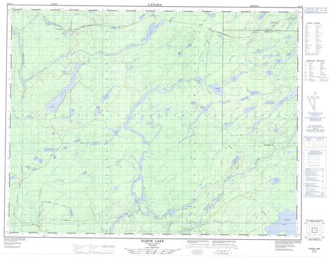
042L04 Elbow Lake Canada topo map, 1:50,000 scale
042L04 Elbow Lake NRCAN topographic map.
Includes UTM and GPS geographic coordinates (latitude and longitude). This 50k scale map is suitable for hiking, camping, and exploring, or you could frame it as a wall map.
Printed on-demand using high resolution, on heavy weight and acid free paper, or as an upgrade on a variety of synthetic materials.
Topos available on paper, Waterproof, Poly, or Tyvek. Usually shipping rolled, unless combined with other folded maps in one order.
- Product Number: NRCAN-042L04
- Parent Topo: TOPO-042L
- Map ID also known as: 042L04, 42L4, 42L04
- Unfolded Size: Approximately 26" high by 36" wide
- Weight (paper map): ca. 55 grams
- Map Type: POD NRCAN Topographic Map
- Map Scale: 1:50,000
- Geographical region: Ontario, Canada
Neighboring Maps:
All neighboring Canadian topo maps are available for sale online at 1:50,000 scale.
Purchase the smaller scale map covering this area: Topo-042L
Spatial coverage:
Topo map sheet 042L04 Elbow Lake covers the following places:
- Gzowski - Oboshkegan - Burnt Island - Angel Lake - Barn Lake - Beeva Lake - Braidwood Lake - Branstrom Lake - Brennan Lake - Chuck Lake - Cork Lake - Coughlan Lake - Crescent Lake - Devanney Lake - Dyer Lake - East Stewart Lake - Eire Lake - Elbow Lake - Esker Lake - Frank Lake - Gay Lake - Gzowski Lake - Hagan Lake - Hawke Lake - Hendrickson Lake - Hook Lake - Hull Lake - Jackson Lake - Jenkins Lake - Knucklethumb Lake - Lake Ste. Marie - Ledingham Lake - Little Gzowski Lake - Little John Lake - Lone Loon Lake - Lunam Lake - MacDonald Lake - McDonough Lake - Metcalfe Lake - North Brennan Lake - North Ridge Lake - Nowlan Lake - Oboshkegan Lake - Onaman Lake - Pauloski Lake - Pigeon Lake - Rip Lake - Robinson Lake - Rout Lake - Sandhills Lake - Savas Lake - Sceptre Lake - Shed Lake - Slate Lake - Slim Lake - South Girvan Lake - South Ridge Lake - Spree Lake - Tashota Lake - Todd Lake - Totem Lake - Ulster Lake - Vancouver Lake - Weewullee Lake - Wells Lake - Jackson Lake Conservation Reserve - Onaman Lake Conservation Reserve - Beeva Creek - Branstrom Creek - East Stewart Creek - Emily Creek - Frank Creek - Girvan Creek - Gzowski Creek - Little John Creek - Little Onion Creek - MacDonald Creek - Metcalfe Creek - Midcross Creek - North Onaman River - Nowlan Creek - Ombabika River - Onaman River - Otter Creek - Rattler Creek - Robinson River - Spree Creek - Stewart Creek - Tashota Creek - Wilgar Creek - Auden - Ombabika - Penequani - Redmond - Tashota


