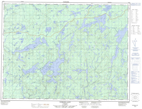
042E05 Barbara Lake Canada topo map, 1:50,000 scale
042E05 Barbara Lake NRCAN topographic map.
Includes UTM and GPS geographic coordinates (latitude and longitude). This 50k scale map is suitable for hiking, camping, and exploring, or you could frame it as a wall map.
Printed on-demand using high resolution, on heavy weight and acid free paper, or as an upgrade on a variety of synthetic materials.
Topos available on paper, Waterproof, Poly, or Tyvek. Usually shipping rolled, unless combined with other folded maps in one order.
- Product Number: NRCAN-042E05
- Parent Topo: TOPO-042E
- Map ID also known as: 042E05, 42E5, 42E05
- Unfolded Size: Approximately 26" high by 36" wide
- Weight (paper map): ca. 55 grams
- Map Type: POD NRCAN Topographic Map
- Map Scale: 1:50,000
- Geographical region: Ontario, Canada
Neighboring Maps:
All neighboring Canadian topo maps are available for sale online at 1:50,000 scale.
Purchase the smaller scale map covering this area: Topo-042E
Spatial coverage:
Topo map sheet 042E05 Barbara Lake covers the following places:
- East Bay - Esker Bay - North Arm - Reef Bay - South Bay - Southwest Bay - Rocky Point - North Channel - Centre Island - Channel Island - Treasure Island - Arrell Lake - Badge Lake - Baffle Lake - Bale Lake - Barbara Lake - Barbaro Lake - Barnacle Lake - Bat Lake - Beartrap Lake - Benson Lake - Blay Lake - Claus Lake - Connor Lake - Cosgrave Lake - Court Lake - Croon Lake - Dempster Lake - Dishpan Lake - Flex Lake - Georgia Lake - Glacier Lake - Jarvis Lake - Jellybean Lake - Kilgour Lake - Lahti Lake - Lake Jean - Leopard Lake - Little Masinabik Lake - Masinabik Lake - McCracken Lake - Mush Lake - Palace Lake - Parget Lake - Parks Lake - Parland Lake - Parole Lake - Peck Lake - Ped Lake - Perky Lake - Peto Lake - Pewit Lake - Phantom Lake - Phasel Lake - Picnic Lake - Piece Lake - Pierce Lake - Pole Lake - Pond Lake - Pratlett Lake - Purva Lake - Rim Lake - Ringlet Lake - Scythe Lake - Seal Lake - Sharp Lake - Shell Lake - Shovel Lake - Silverskin Lake - Slush Lake - Snare Lake - Solar Lake - Sovereign Lake - Squawk Lake - Straw Lake - Threesided Lake - Trapnarrows Lake - Triangle Lake - Upper Roslyn Lake - Weitzel Lake - Woodpigeon Lake - Beardmore - Nakina - Babe Creek - Basin Creek - Candy Creek - Croon Creek - Dishpan Creek - East Jackpine River - Glacier Creek - Jackfish River - Jackpine River - Kilgour Creek - Little Blackwater Creek - Little Blackwater River - Little Postagoni River - Masinabik Creek - Namewaminikan River - Parland Creek - Parole Creek - Phantom Creek - Pomace Creek - Postagoni River - Pound Creek - Pratlett Creek - Rim Creek - Snare Creek - Trapnarrows Creek - West Gravel River - Long Portage - Greenstone


