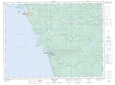
042D09 Marathon Canada topo map, 1:50,000 scale
042D09 Marathon NRCAN topographic map.
Includes UTM and GPS geographic coordinates (latitude and longitude). This 50k scale map is suitable for hiking, camping, and exploring, or you could frame it as a wall map.
Printed on-demand using high resolution, on heavy weight and acid free paper, or as an upgrade on a variety of synthetic materials.
Topos available on paper, Waterproof, Poly, or Tyvek. Usually shipping rolled, unless combined with other folded maps in one order.
- Product Number: NRCAN-042D09
- Parent Topo: TOPO-042D
- Map ID also known as: 042D09, 42D9, 42D09
- Unfolded Size: Approximately 26" high by 36" wide
- Weight (paper map): ca. 55 grams
- Map Type: POD NRCAN Topographic Map
- Map Scale: 1:50,000
- Geographical region: Ontario, Canada
Neighboring Maps:
All neighboring Canadian topo maps are available for sale online at 1:50,000 scale.
Purchase the smaller scale map covering this area: Topo-042D
Spatial coverage:
Topo map sheet 042D09 Marathon covers the following places:
- Beatty Cove - Carden Cove - Happy Harbour - Hattie Cove - Heron Bay - Island Harbour - Jellicoe Cove - Mud Bay - Peninsula Bay - Peninsula Harbour - Picture Rock Harbour - Pitch Rock Harbour - Playter Harbour - Prospect Cove - Pulpwood Harbour - Campbell Point - Neuve Chapelle Point - Randle Point - The Peninsula - Ypres Point - Yser Point - Chigamiwinigum Falls - Umbata Falls - 74 - 75 - 77 - Cotte - Lecours - McCoy - Pic - Thunder Bay - Pic River 50 - Pic River Indian Reserve 50 - Réserve indienne Pic River 50 - Blondin Island - C.P.R. Island - Channel Island - Dampier Islands - Hawkins Island - Ogilvy Point - Picture Island - Skin Island - Bells Lake - Cache Lake - Camp 14 Lake - Camp 36 Lake - Campfire Lake - Elk Lake - Ell Lake - Gowan Lake - Gulliver Lake - Gus Lake - Hayward Lake - Lac Supérieur - Lake Superior - Log Pond - Lunam Lake - Melgund Lake - Mussy Lake - Onpaco Lake - Pen Lake - Penn Lake - Rous Lake - Shack Lake - Swamp Lake - Three Finger Lake - Peninsula Hill - Craig's Pit Provincial Nature Reserve - Parc national du Canada Pukaskwa - Pukaskwa National Park of Canada - Craigs Pit - Black River - Brush Creek - Camp 14 Creek - Campfire Creek - Gowan Creek - Gulliver Creek - Gus Creek - Hayward Creek - Jordon Creek - Little Black River - Melgund Creek - Mussy Creek - Onpaco Creek - Pic River - Spruce Creek - Swede Creek - White River - Chigamiwinigum Portage - Umbata Portage - Boulton Reef - Keating Rock - Lash Rock - Manitoba Shoal - Meaux Shoal - Senlis Shoal - Uncle Bobs Bank - Marathon - Heron Bay - Marathon - Melgund - Pic River - Pringle


