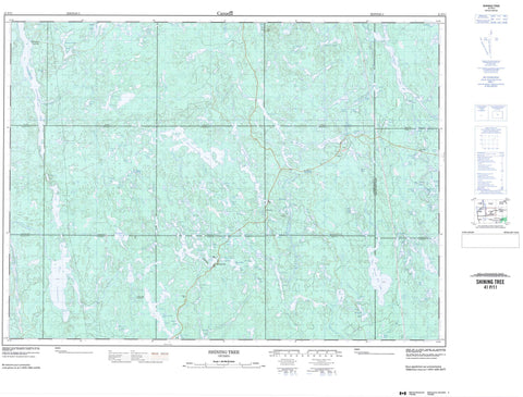
041P11 Shining Tree Canada topo map, 1:50,000 scale
041P11 Shining Tree NRCAN topographic map.
Includes UTM and GPS geographic coordinates (latitude and longitude). This 50k scale map is suitable for hiking, camping, and exploring, or you could frame it as a wall map.
Printed on-demand using high resolution, on heavy weight and acid free paper, or as an upgrade on a variety of synthetic materials.
Topos available on paper, Waterproof, Poly, or Tyvek. Usually shipping rolled, unless combined with other folded maps in one order.
- Product Number: NRCAN-041P11
- Parent Topo: TOPO-041P
- Map ID also known as: 041P11, 41P11
- Unfolded Size: Approximately 26" high by 36" wide
- Weight (paper map): ca. 55 grams
- Map Type: POD NRCAN Topographic Map
- Map Scale: 1:50,000
- Geographical region: Ontario, Canada
Neighboring Maps:
All neighboring Canadian topo maps are available for sale online at 1:50,000 scale.
Purchase the smaller scale map covering this area: Topo-041P
Spatial coverage:
Topo map sheet 041P11 Shining Tree covers the following places:
- Claw Creek Bay - Southeast Arm - West Arm - Asquith - Brunswick - Cabot - Churchill - Connaught - Fawcett - Kelvin - Knight - Leonard - Londonderry - Macmurchy - Miramichi - Natal - Timiskaming - Togo - Tyrrell - McCrae Island - McRae Island - Allin Lake - Arthur Lake - Ashburn Lake - Baker Lake - Barite Lake - Beilby Lake - Bigfour Lake - Bing Lake - Bob Lake - Bobtail Lake - Breeze Lake - Brush Lake - Burns Lake - Cabot Lake - Caput Lake - Caswell Lake - Chlorus Lake - Chris Lake - Clapper Lake - Clark Lake - Claw Lake - Cochrane Lake - Cond Lake - Connaught Lake - Cripple Lake - Cryderman Lake - East Shining Tree Lake - Elephant Head Lake - Eliza Lake - Eplett Lake - Esther Lake - Fawcett Lake - Foisey Lake - Foley Lake - Fournier Lake - Foxhead Lake - Frith Lake - Gary Lake - Gay Lake - Gordon Lake - Gosselin Lake - Granite Lake - Hare Lake - Hassett Lake - Herron Lake - Hook Lake - Houston Lake - Hydro Lake - Indian Lake - Jefferson Lake - Jepson Lake - Jerry Lake - Jess Lake - Jesse James Lake - Jonson Lake - Kelvin Lake - Ketchiwaboose Lake - Knothole Lake - Knox Lake - Lehmann Lake - Little Claw Lake - Little Esther Lake - Little Papoose Lake - Little Pigeon Lake - Lower Opikinimika Lake - Lucid Lake - Macdonald Lake - Macfie Lake - Marion Lake - Marne Lake - Marshrat Lake - Mataris Lake - Mattagami Lake - McIntyre Lake - Melia Lake - Michiwakenda Lake - Milly Lake - Miramichi Lake - Moon Lake - Moorecamp Lake - Mullen Lake - Nabakwasi Lake - Natal Lake - Nora Lake - North Foley Lake - Notround Lake - Oddur Lake - Okawakenda Lake - Ola Lake - Owl Lake - Papoose Lake - Pat Lake - Perkins Lake - Picket Lake - Pigeon Lake - Porphyry Lake - Ragen Lake - Rebecca Lake - Ribble Lake - Robbie Lake - Rosalie Lake - Sams Lake - Sandstrum Lake - Saville Lake - Seager Lake - Seganku Lake - Shining Tree Lake - Soot Lake - South Sandstrum Lake - Spade Lake - Speed Lake - Spider Lake - Spud Lake - Stewart Lake - Taylor Lake - Tetrapus Lake - Thorn Lake - Tiger Lake - Tina Lake - Upper Grassy Lake - Violet Lake - Wanatangua Lake - Waonga Lake - Wasapika Lake - West Shining Tree Lake - Wire Lake - MacMurchy Township End Moraine Provincial Park - Calcite Rapids - Elbow Rapids - Houston Rapids - Ribble Rapids - Baker Creek - Bigfour Creek - Bobtail Creek - Breeze Creek - Chlorus Creek - Claw Creek - Donnegana River - Elephant Head Creek - Esther Creek - Foley Creek - Gosselin Creek - Hanover Creek - Hare Creek - Hydro Creek - Jess Creek - Jesse James Creek - Kelvin Creek - Marion Creek - Marne Creek - Milly Creek - Nabakwasi River - Natal Creek - Opikinimika River - Papoose Creek - Perth Creek - Pigeon Creek - Rebecca Creek - Sandstrum Creek - Saville Creek - Seager Creek - Seganku Creek - Shining Tree Creek - Spade Creek - Spider Creek - Sulphide Creek - West Montreal River - West Shining Tree Creek - West Wapus Creek - Mattagami Landing - Shining Tree - Tyranite


