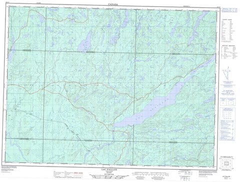
032C07 Lac Faillon Canada topo map, 1:50,000 scale
032C07 Lac Faillon NRCAN topographic map.
Includes UTM and GPS geographic coordinates (latitude and longitude). This 50k scale map is suitable for hiking, camping, and exploring, or you could frame it as a wall map.
Printed on-demand using high resolution, on heavy weight and acid free paper, or as an upgrade on a variety of synthetic materials.
Topos available on paper, Waterproof, Poly, or Tyvek. Usually shipping rolled, unless combined with other folded maps in one order.
- Product Number: NRCAN-032C07
- Parent Topo: TOPO-032C
- Map ID also known as: 032C07, 32C7, 32C07
- Unfolded Size: Approximately 26" high by 36" wide
- Weight (paper map): ca. 55 grams
- Map Type: POD NRCAN Topographic Map
- Map Scale: 1:50,000
- Geographical region: Quebec, Canada
Neighboring Maps:
All neighboring Canadian topo maps are available for sale online at 1:50,000 scale.
Purchase the smaller scale map covering this area: Topo-032C
Spatial coverage:
Topo map sheet 032C07 Lac Faillon covers the following places:
- Baie Kâwacidawâgak - Baie Pitou - Baie Sylvie - Plage des Boudeurs - Pointe Kâmâdjitehak Onâganikak - Boisseau - Brassier - Crusson - Dollard - Faillon - Jurie - Martin - Tavernier - Valets - Lac Abel - Lac Adjutor - Lac Alma - Lac Bastien - Lac Beaudet - Lac Beaulieu - Lac Bird - Lac Burrell - Lac Cacamackipato - Lac Daigneault - Lac David - Lac de la Queue Carrée - Lac de l'Avion - Lac Délisle - Lac Delta - Lac Doyon - Lac du Doc - Lac du Héron Bleu - Lac du Maire-Bilodeau - Lac Ducheneau - Lac Faillon - Lac Godin - Lac Gosselin - Lac Henri - Lac Ida - Lac Jacques - Lac Kâhobâkacik - Lac Kâkâgî - Lac Kâkinogâmak - Lac Kâkomowadek - Lac Kâmickikwagamak - Lac Kâwininonamebanekak - Lac Lachance - Lac Lalochetière - Lac Lamarche - Lac Laporte - Lac Laurent - Lac Lena - Lac Louis - Lac Martin - Lac Millie - Lac Nanou - Lac Negoganatek - Lac Ogâsanani - Lac Pascal - Lac Paul - Lac Pichette - Lac Pitou - Lac Régis - Lac Robitaille - Lac Ubald - Lac Valets - Lac Wilbrod - Lacs Jaco - Lacs Kâpiskagamak - Lacs Nîsin - Mont B.-B.-C. - Mont de la Source - Parc Romuald-Simard - Kâkomowadek - Kawakonikagamak - Pockodjekwajicik Kodjidjik - Pockodjekwajicik Sâgik - Rivière Bastien - Rivière Brassier - Rivière Collin - Rivière Courville - Rivière Mégiscane - Rivière Tavernier - Ruisseau Aimé - Ruisseau Arthur - Ruisseau B.-B.-C. - Ruisseau Brown - Ruisseau Cedar - Ruisseau Croche - Ruisseau Crooked - Ruisseau du Canyon - Ruisseau Godin - Ruisseau Jaco - Ruisseau Jacques - Ruisseau Jim - Ruisseau Kâwacidawâgak - Ruisseau Rossignol - Ruisseau Salvador - Ruisseau Signay - Ruisseau Smoky - Ruisseau Sunday - Ruisseau Wilfrid - Signai


