
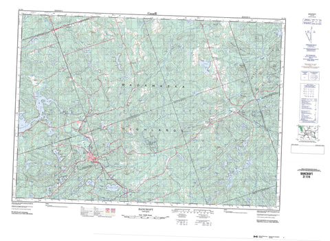
031F04 Bancroft Canada topo map, 1:50,000 scale
031F04 Bancroft NRCAN topographic map.
Includes UTM and GPS geographic coordinates (latitude and longitude). This 50k scale map is suitable for hiking, camping, and exploring, or you could frame it as a wall map.
Printed on-demand using high resolution, on heavy weight and acid free paper, or as an upgrade on a variety of synthetic materials.
Topos available on paper, Waterproof, Poly, or Tyvek. Usually shipping rolled, unless combined with other folded maps in one order.
- Product Number: NRCAN-031F04
- Parent Topo: TOPO-031F
- Map ID also known as: 031F04, 31F4, 31F04
- Unfolded Size: Approximately 26" high by 36" wide
- Weight (paper map): ca. 55 grams
- Map Type: POD NRCAN Topographic Map
- Map Scale: 1:50,000
- Geographical region: Ontario, Canada
Neighboring Maps:
All neighboring Canadian topo maps are available for sale online at 1:50,000 scale.
Purchase the smaller scale map covering this area: Topo-031F
Spatial coverage:
Topo map sheet 031F04 Bancroft covers the following places:
- Branch Bay - Dog Bay - Horseshoe Bay - Lavalley Bay - Norway Bay - Redmond Bay - Dry Narrows - Green Narrows - The Eagles Nest - Egan Chute - Farm Chute - Loneys Chute - McArthur Falls - The Big Chute - Ashby - Carlow - Cashel - Dungannon - Faraday - Hastings - Herschel - Lennox and Addington - Mayo - McClure - Monteagle - Raglan - Renfrew - Wicklow - Aide Lake - Albion Lake - Banner Lake - Baptiste Lake - Baragar Lake - Bartlett Lake - Batelle Lake - Baumheur Lake - Bay Lake - Belton Lake - Bentley Lake - Bigfools Lake - Bird Lake - Bow Lake - Bradley Lake - Bresnahan Lake - Brethour Lake - Bronson Lake - Bulpit Lake - Burke Lake - Cannon Lake - Card Lake - Carfrae Lake - Chip Lake - Chubb Lake - Clark Lake - Coe (Island) Lake - Coltson Lake - Copper Lake - Cullin Lake - Derry Lake - Dickens Lake - Dodds Lake - Edward Lake - Faraday Lake - Fitzgibbon Lake - Foster Lake - Fosters Lake - Fraser Lake - Gaffney Lake - Gin Lake - Goddard Lake - Gould Lake - Grace Lake - Graphite Lake - Grassy Lake - Greenbark Lake - Holland Lake - Hound Lake - Hughes Lake - Hybla Lake - Hynes Lake - Jamieson Lake - Jeffrey Lake - L'Amable Lake - Laundry Lake - Ledyard Lake - Lily Lake - Limestone Lake - Little Bear Pond - Little Birch Lake - Little Black Lake - Little Mayo Lake - Little Mullet Lake - Little Sharrow Lake - Little Sunken Lake - Little Wanamaker Lake - Littlefools Lake - Lornies Lake - Lost Lake - Lucerne Lake - Lunan Lake - Mallard Lake - Marble Lake - Mayo Lake - McCormick Lake - McFall Lake - McGibbon Lake - McWhirter Lake - Mitchell Lake - Moccasin Lake - Moxam Lake - Mullet Lake - Nobbs Lake - North Vance Lake - O'Neill Lake - O'Shaughnessy Lake - Parkhurst Lake - Peacock Lake - Pipe Lake - Plunkett Lake - Pope Lake - Pritchard Lake - Quarry Lake - Quirk Lake - Raggan Ponds - Riddell Lake - Riddles Lake - Rutledge Lake - Salmon Trout Lake - Salt Lake - Selby Lake - Sharrow Lake - Siddon Lake - Smith Lake - South Boundary Lake - Spruce Lake - Spurr Lake - Stevens Lake - Stimears Lake - Stranyer Lake - Stringer Lake - Swordfingal Lake - Tait Lake - Tamarack Lake - The Chain Lakes - Tim Lake - Trip Lake - Trolly Lake - V Lake - Vanluven Lake - Venalen Lake - Wanamaker Lake - Waterhouse Lake - West Mullet Lake - Whitefoot Lake - Whyte Lake - Williams Lake - Wojashk Lake - Young Lake - Beaudries Mountain - Bruces Mountain - Eaglesnest Hill - Hardwood Mountain - Inwoods Hill - Loneys Hill - Madawaska Highlands - Murphys Mountain - Parkhurst Mountain - Raglan Hills - Salt Mountain - Tower Mountain - Hastings - Lennox and Addington - Renfrew - Addington Highlands - Bangor, Wicklow and McClure - Brudenell and Lyndoch - Brudenell, Lyndoch and Raglan - Carlow - Carlow/Mayo - Denbigh, Abinger and Ashby - Dungannon - Faraday - Hastings Highlands - Herschel - Kaladar, Anglesea and Effingham - Mayo - Monteagle - Raglan - Tudor and Cashel - Egan Chutes Provincial Nature Reserve - Egan Chutes Provincial Park Addition - Little Mississippi River Conservation Reserve - Conroy Rapids - Daveys Rapids - The Valley Rapids - Aide Creek - Bentley Creek - Bird Creek - Bowen Creek - Bresnahan Creek - Cannon Creek - Cedar Creek - Clark Creek - Egan Creek - Faraday Creek - Fraser Creek - Gin Creek - Goodkey Creek - Grace Creek - Hestler Creek - Kelly Creek - L'Amable Creek - Lily Creek - Little Mississippi River - Lunan Creek - Mallard Creek - McGarry Creek - Moccasin Creek - Mullet Creek - Murphys Creek - Papineau Creek - Pennocks Creek - Quarry Creek - Quirk Creek - Rowland Creek - Salmon Trout Creek - Salt Creek - Selby Creek - Sharrow Creek - Stringer Creek - Whyte Creek - York River - The Great Bend - Bancroft - Bancroft - Baptiste - Beechmount - Bessemer - Bessemer Junction - Birds Creek - Boulter - Bowen Corner - Bronson - Bronson Station - Childs Mines - Detlor - Egan Creek - Fort Stewart - Graphite - Green Corners - Greenview - Hartsmere - Havergal - Hermon - Hickey Settlement - Hughes - Hybla - Ireland - L'Amable - Maxwell - Maxwell Settlement - Maynooth - Maynooth Station - McAlpine Corners - McArthurs Mills - McGarry Flats - McGary Flats - Monck Road - Monteagle Valley - Musclow - New Hermon - Nobbs Siding - Rowland - Scotch Bush - Scott Settlement - Upper Hermon - Vardy - Vardy Settlement - York River - Kings Marsh - The Red Marsh


