
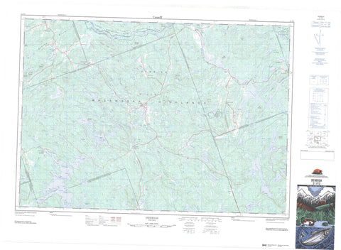
031F03 Denbigh Canada topo map, 1:50,000 scale
031F03 Denbigh NRCAN topographic map.
Includes UTM and GPS geographic coordinates (latitude and longitude). This 50k scale map is suitable for hiking, camping, and exploring, or you could frame it as a wall map.
Printed on-demand using high resolution, on heavy weight and acid free paper, or as an upgrade on a variety of synthetic materials.
Topos available on paper, Waterproof, Poly, or Tyvek. Usually shipping rolled, unless combined with other folded maps in one order.
- Product Number: NRCAN-031F03
- Parent Topo: TOPO-031F
- Map ID also known as: 031F03, 31F3, 31F03
- Unfolded Size: Approximately 26" high by 36" wide
- Weight (paper map): ca. 55 grams
- Map Type: POD NRCAN Topographic Map
- Map Scale: 1:50,000
- Geographical region: Ontario, Canada
Neighboring Maps:
All neighboring Canadian topo maps are available for sale online at 1:50,000 scale.
Purchase the smaller scale map covering this area: Topo-031F
Spatial coverage:
Topo map sheet 031F03 Denbigh covers the following places:
- Johnston Bay - Laundry Bay - Proudfoot Bay - West Bay - White Bay - Wilson Bay - Wilson Bay - Camel Chute - Slate Falls - Abinger - Ashby - Brougham - Cashel - Denbigh - Effingham - Frontenac - Griffith - Hastings - Lennox and Addington - Lyndoch - Matawatchan - Mayo - Miller - Raglan - Renfrew - Anderson Island - Bald Island - Bevis Island - Big Island - Bird Island - Craig Island - Gibraltar Island - Green Island - Gull Island - Hams Island - Honeymoon Island - Horseshoe Island - Illahoe Island - Ketcheson Island - Lyman Island - Rockwells Island - Round Island - Sullivan Island - Walker Island - Weddell Island - Aird Lake - Alfes Lake - Anna Lake - Arnott Lake - Ashby Lake - Ashby White Lake - Ashden Lake - Bailey Lake - Ball Lake - Barker Lake - Barnard Lake - Bartsch Lake - Bear Pond - Bearsmouth Lake - Beaudrie Lake - Beaver Lake - Beaver Pond - Beebee Lake - Beeches Lake - Beef Lake - Big Birch Lake - Big Limestone Lake - Big Ohlmann Lake - Big Yirkie Lake - Blackbass Lake - Blakely Lake - Blueberry Lake - Bobs Lake - Bradley Lake - Brooks Lake - Browns Lake - Brule Lake - Brule Lake - Brûlé Lake - Buck Lake - Buck Shanty Lake - Buckshot Lake - Centennial Lake - Chapman Lake - Chip Lake - Chouinard Lake - Connors Lake - Copeland Lake - Cotter Lake - Crankshaw Lake - Crooked Lake - Crystal Lake - Dan Lake - Deep Lake - Denbigh Lake - Denbigh Long Lake - Dog Lake - Doig Lake - Dougs Lake - Druces Lake - Dry Lake - Dubrois Lake - Dunham Lake - Dunns Lakes - Dutchmans Lake - East Lake - Effingham Lake - Eno Lake - Finch Lake - Flake Lake - Fortune Lake - Fox Lake - Francis Lake - Frank Ponds - Fritsch Lake - Garner Lake - Genricks Lake - Giffins Lake - Goods Lake - Graham Lake - Grants Lake - Green Lake - Greggs Lake - Hardwood Lake - Hardwood Lake - Heath Lake - Heidermans Lake - Holmes Lake - Hopkins Lake - Horseshoe Lake - Hughes Lake - Hutson Lake - Inner Duck Lake - Irvine Lake - Johnsons Lake - King Lake - Kings Lake - Kleim Lake - Lane Lake - Leatherroot Lake - Leclaire Lake - Leidtke Lake - Len Lake - Little Barker Lake - Little Birch Lake - Little Cedar Lake - Little Finch Lake - Little Fox Lake - Little Green Lake - Little Lake - Little Lake - Little Limestone Lake - Little Long Lake - Little Moose Lake - Little Spruce Lake - Little Yirkie Lake - Long Mallory Lake - Lost Lake - Lost Lake - Lucky Lake - Mackavoy Lake - Mackie Lake - Marquardts Lake - Marshall Lake - McCharles Lake - McFadden Lake - McHale Lake - Mieske Lake - Milty Lake - Mistry Lake - Mocassin Lake - Moccasin Lake - Moger Pond - Montgomerys Lake - Montserrat Lake - Moore Lake - Morrow Lake - Mountney Lake - Mouse Lake - Mowry Lake - Mud Lake - Noisy Lake - North Lake - Northeast Lake - Nowlan Lake - Oakhill Lake - Ostler Lake - Otter Lake - Outer Duck Lake - Pake Lake - Papolka Lake - Peever Lake - Pine Lake - Plotz Lake - Poplar Lake - Portage Lake - Presley Lake - Quackenbush Lake - Raddle Lake - Rahm Lake - Rainy Lake - Rettans Lake - Robinson Lake - Rodger Lake - Rolufs Lake - Rose Lake - Rosenblath Lake - Round Schooner Lake - Ruby Lake - Saptrough Lake - Shanty Lake - Shaw Lake - Shiner Lake - Simpson Lake - Slater Lake - Sleeper Lake - Smith Lake - Snake Lake - Spring Lake - Stewart Lake - Stewart Long Lake - Stony Pond - Stringers Lake - Strong Lake - Sweetman Lake - The Duck Lakes - Thirty Eight Lake - Toor Lake - Trapper Lake - Triple Lake - Trout Lake - Turtle Lake - Twinbear Lake - Twinbear Lakes - Twintoor Lakes - Upper Bear Pond - Vans Lake - Vantassel Lake - Vernicks Lake - Vilneffs Lake - Virginia Lake - Wankie Lake - Wensley Lake - Weslemkoon Lake - Wickware Lake - Wilson Lake - Winter Road Lake - Beaudries Mountain - Birch Hill - Black Donald Hills - Black Mountain - Bluff Mountain - Boiceys Mountain - Carswells Mountain - Crankshaw Hill - Dans Mountain - Denbigh Hills - Eagle Hill - Eagle Hills - Finch Hill - Grosklags Hill - Icy Hills - Jamiesons Mountain - Jocko Mountain - Johnsons Mountain - Leatherroot Mountain - Limestone Rock - Madawaska Highlands - Mallory Hill - McLaughlins Hill - Mount Jamieson - Mount Nowlan - Mount Ohlmann - Nowlans Mountain - Oak Hills - Oak Ridge - Ohlmanns Mountain - Pine Hill - Pine Ridge - Raglan Hills - Rattan Mountain - Rose Hill - Slate Falls Mountain - Stringers Mountain - Thompson Mountain - Tower Mountain - Turtle Lake Hills - Frontenac - Hastings - Lennox and Addington - Renfrew - Addington Highlands - Bagot and Blythfield - Bagot, Blythfield and Brougham - Barrie - Brougham - Brudenell and Lyndoch - Brudenell, Lyndoch and Raglan - Carlow - Carlow/Mayo - Clarendon and Miller - Denbigh, Abinger and Ashby - Greater Madawaska - Griffith and Matawatchan - Kaladar, Anglesea and Effingham - Mayo - North Frontenac - Palmerston and North and South Canonto - Raglan - Tudor and Cashel - Centennial Lake Provincial Nature Reserve - Lower Madawaska River Provincial Park - Matawatchan Provincial Nature Reserve - Matawatchan Provincial Park - Colton Rapids - Crooked Rapids - Dog Leg Rapids - Exam Time Rapids - Island Rapids - Paddys Rapids - Rackett Rapids - Rifle Chute - Shallow Rapids - Snake Rapids - Split Rock Rapids - The Narrows - Wadsworth Rapids - Wolfe Rapids - Aide Creek - Ashby Creek - Barnard Creek - Browns Creek - Buckshot Brook - Buckshot Creek - Coburn Creek - Colton Creek - Copeland Creek - Crystal Creek - Doig Creek - Donnelly Creek - Glenfield Creek - Godin Creek - Graham Creek - Hardwood Creek - Heath Creek - Henderson Creek - Hutcheson Creek - Hydes Creek - Johns Creek - Kilpecker Creek - Lackey Creek - Leidtke Creek - Lily Creek - Little Mississippi River - Little Snake Creek - Louse Creek - Mackie Creek - Madawaska River - Mallory Creek - McDougalls Creek - Milty Creek - Mississippi River - Morrow Creek - Mountney Creek - Skead Creek - Snake Creek - Steins Creek - Vans Creek - Vantassel Creek - Winter Road Creek - Ashby Lake - Bruceton - Camel Chute - Caverlys Landing - Denbigh - Ferguson Corners - Glenfield - Griffith - Hardwood Lake - Matawatchan - Rose Hill - Ruby - Ruby Mine - Schutt - Slate Falls - Vennachar - Vennachar Junction - Walkers Corner - Wensley - Wilson - McKenzie Marsh


