
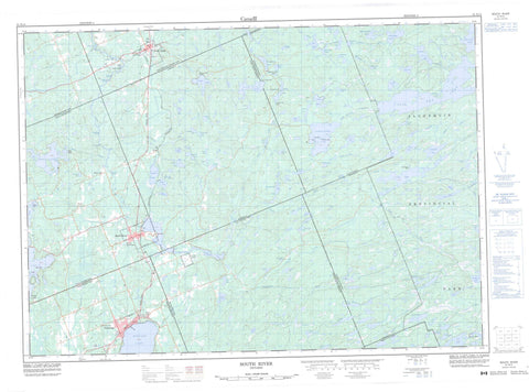
031E14 South River Canada topo map, 1:50,000 scale
031E14 South River NRCAN topographic map.
Includes UTM and GPS geographic coordinates (latitude and longitude). This 50k scale map is suitable for hiking, camping, and exploring, or you could frame it as a wall map.
Printed on-demand using high resolution, on heavy weight and acid free paper, or as an upgrade on a variety of synthetic materials.
Topos available on paper, Waterproof, Poly, or Tyvek. Usually shipping rolled, unless combined with other folded maps in one order.
- Product Number: NRCAN-031E14
- Parent Topo: TOPO-031E
- Map ID also known as: 031E14, 31E14
- Unfolded Size: Approximately 26" high by 36" wide
- Weight (paper map): ca. 55 grams
- Map Type: POD NRCAN Topographic Map
- Map Scale: 1:50,000
- Geographical region: Ontario, Canada
Neighboring Maps:
All neighboring Canadian topo maps are available for sale online at 1:50,000 scale.
Purchase the smaller scale map covering this area: Topo-031E
Spatial coverage:
Topo map sheet 031E14 South River covers the following places:
- Corkery Falls - Cox Chute - Davidson Chute - Freeman Chute - Geisler Chute - Gimball Chute - Gitzler Falls - Truisler Chute - Ballantyne - Biggar - Butt - Gurd - Himsworth - Joly - Laurier - Machar - Nipissing - North Himsworth - Parry Sound - Paxton - Proudfoot - South Himsworth - Strong - Wilkes - Broncho Island - Camp Island - Edgar Island - Hall Island - Hondoo Island - Inglis Island - Little Island - Axton Lake - Bacon Lake - Baimwawa Lake - Ballantyne Lake - Basil Lake - Beautiful Lake - Bernard Lake - Big Bob Lake - Bluesky Lake - Boon Lake - Bopeep Lake - Bray Lake - Butterfield Lake - Capsell Lake - Cayuga Lake - Charr Lake - Chibiabos Lake - Corkery Lake - Corncob Lake - Cornick Lake - Craig Lake - Dead Horse Lake - Denis Lake - Dight Lake - Eagle Lake - Edwards Lake - Ever Lake - Forest Lake - Gandalore Lake - Genesee Lake - Goose Egg Lake - Ham Lake - HamiltonLake - Harkness Lake - Hawe Lake - Hinsburger Lake - Indian Pipe Lake - Jeepi Lake - Kakasamic Lake - Kawawaymog Lake - Keewaydin Lake - King Lake - Koko Lake - Kuwasda Lake - Kwonishi Lake - Lambs Lake - Laurier Lake - Little Hemlock Lake - Little Peyton Lake - Little Tyne Lake - Long Lake - Lorne Lake - Lost Dog Lake - Louck Lake - Loxton Lake - Lynch Lake - Machar Lake - Manitou Lake - Maryjane Lake - Mattowacka Lake - Moose Lake - Mujekiwis Lake - Music Lake - Nahma Lake - Namegos Lake - North Tea Lake - Osborne Lake - Otter Lake - Paisley Lake - Pat Lake - Paxton Lake - Pemican Lake - Peyton Lake - Pipe Lake - Pishnecka Lake - Sahwa Lake - Sally Lake - Sausage Lake - Scheil Lake - Seven Lake - Shaw Lake - Sisco Lake - Siscowet Lake - Smyth Lake - Starvation Lake - Stephen Lake - Stove Lake - Stranger Lake - Stringer Lake - Tim Lake - Timpano Lake - Togo Lake - Tower Lake - Twelve Lake - Twentyseven Lake - Twin Lakes - Tyne Lake - Wabanah Lake - Waskigomog Lake - Wendigo Lake - West Koko Pond - Wet Lake - Wilkes Lake - Winifred Lake - Wrights Pond - Yenadizze Lake - Himsworth South - Joly - Machar - Nipissing - Strong - Algonquin Provincial Park - Bray Lake Conservation Reserve - Joly Township Hardwoods Conservation Reserve - Louck Lake Wetland Conservation Reserve - Sausage Lake Forest Conservation Reserve - South River Forest Conservation Reserve - Amable du Fond River - Baimwawa Creek - Bopeep Creek - Bray Creek - Cayuga Creek - Chibiabos Creek - Corkery Creek - Craig Creek - Ewayea Creek - Kakasamic Creek - Lorne Creek - Nipissing River - Nokomis Creek - North Magnetawan River - Pishnecka Creek - Smith Creek - Smyth Creek - South River - Tim River - Tyne Creek - Wabanah Creek - Kearney - Powassan - Bray Lake - Deans - Eagle Lake - Maecks Subdivision - Trout Creek - South River - Sundridge


