
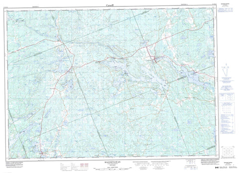
031E12 Magnetawan Canada topo map, 1:50,000 scale
031E12 Magnetawan NRCAN topographic map.
Includes UTM and GPS geographic coordinates (latitude and longitude). This 50k scale map is suitable for hiking, camping, and exploring, or you could frame it as a wall map.
Printed on-demand using high resolution, on heavy weight and acid free paper, or as an upgrade on a variety of synthetic materials.
Topos available on paper, Waterproof, Poly, or Tyvek. Usually shipping rolled, unless combined with other folded maps in one order.
- Product Number: NRCAN-031E12
- Parent Topo: TOPO-031E
- Map ID also known as: 031E12, 31E12
- Unfolded Size: Approximately 26" high by 36" wide
- Weight (paper map): ca. 55 grams
- Map Type: POD NRCAN Topographic Map
- Map Scale: 1:50,000
- Geographical region: Ontario, Canada
Neighboring Maps:
All neighboring Canadian topo maps are available for sale online at 1:50,000 scale.
Purchase the smaller scale map covering this area: Topo-031E
Spatial coverage:
Topo map sheet 031E12 Magnetawan covers the following places:
- Cranberry Bay - Deep Bay - Forkers Bay - Fraser Bay - Gibsons Bay - Grassy Bay - Green Bay - Hamiltons Bay - Holts Bay - Hudsons Bay - Kelcey's Mill Pond - Lawson Bay - Longarm Bay - Lost Bay - Moore Bay - Newell Bay - Old Mill Bay - Poverty Bay - Short Bay - Tahinca Cove - Birch Point - Catfish Rock - Creasor's Rock - Feighen Point - Gun Point - Hammer Point - Lone Rock Point - Pickerel Point - Picnic Point - Pinetree Point - Pleasant Point - Powell's Point - Rocky Reef Point - Round Point - Sample Point - Dunchurch Narrows - Dunchurch Second Narrows - Hargrave Narrows - The Grass - The Narrows - Knoefli Falls - Lower Burnt Chute - Lower Burnt Chute - Poverty Bay Chutes - Upper Burnt Chute - Upper Burnt Chute - Burpee - Chapman - Croft - East Burpee - Ferguson - Ferrie - Hagerman - Lount - McKellar - McKenzie - McMurrich - Parry Sound - Ryerson - Spence - Strong - Andy Island - Bald Island - Bella Island - Birch Island - Brown's Island - Cameron Island - Campbell Island - Canning Island - Clifton Island - Dobbs Island - Doc's Island - Echo Island - Ferris Island - Gordon Island - Hosick Island - Jubilee Island - Little Island - Macfie Island - Maple Island - Millin Island - Moore Island - One Tree Island - Petrita Island - Powell Island - Pratt's Island - Rock Island - Simpson Islands - Whitestone Island - Wolf Island - Wolfe Island - Ahmic Lake - Ainslie Lake - Armstrong Lake - Bartlett Lake - Bat Lake - Beasley Lake - Beaver Lake - Beckett Lake - Bell Lake - Bells Lake - Bishop Lake - Blackberry Lake - Blue Lake - Bosley Pond - Brownley Lake - Canning Lake - Carmen Lake - Carrington Lake - Cecebe Lake - Clear Lake - Clear Lake - Cooper Lake - Crawford Lake - De Bois Lake - Dun Lake - Dunchurch Lake - Fairholme Lake - Falby Lake - Ford Lake - Goose Lake - Gordon Lake - Grey Owl Lake - Harrison Lake - Henry Lake - Highrock Lake - Hobson Lake - Horn Lake - Hosick Lake - Hughes Lake - Jeffery Lake - Johnson Lake - Keiller Lake - La Brash Lake - Lake Cecebe - Larch Lake - Limestone Lake - Little Harris Lake - Little McKellar Lake - Little Ruebottom Lake - Little Snakeskin Lake - Little Spring Lake - Lodge Lake - Lorimer Lake - Love Lake - Manitouwabing Lake - Manson Lake - Mary Jane Lake - McEwen Lake - McKellar Lake - McLennan Lake - Midlothian Lake - Moffat Lake - Moulton Lake - Mud Lake - Neighick Lake - Nelson Lake - Newell Lake - Ogden Lake - Old Mans Lake - Oliver Lake - Orange Lake - Parker Lake - Pearceley Lake - Pinetree Lake - Plumptre Lake - Quinn Lake - Rainy Lake - Robertson Lake - Robinson Lake - Round Lake - Ruebottom Lake - Ryan Lake - Ryder Lake - Saltlick Lake - Saunders Lake - Schmeiler Lake - Seguin Lake - Shanty Lake - Shawanaga Lake - Simmons Lake - Simolea Lake - Simpson Lake - Snake Lake - Snakeskin Lake - Sollman Lake - Spence Lake - Spring Lake - Squaw Lake - Stinking Lake - Tarrant Lake - Taylor Lake - The Top Lake - Truax Lake - Twin Lakes - Vowel Lake - Wahwashkesh Lake - Watson Lake - Wauby Lake - Whalley Lake - Whitestone Lake - Wilson Lake - Blueberry Hill - Spyglass Hill - Chapman - Hagerman - Magnetawan - Magnetawan - McDougall - McKellar - McMurrich - McMurrich/Monteith - Ryerson - Strong - Whitestone - Ahmic Forest and Rock Barrens Conservation Reserve - Bear Lake Peatland Conservation Reserve - Ferrie Township Forest Conservation Reserve - Island Lake Forest and Barrens Conservation Reserve - Little Spring Lake Conservation Reserve - Ryerson Township Forest Conservation Reserve - Shawanaga Lake Conservation Reserve - Cody Rapids - Lovesick Rapids - Markham Rapids - Needles Eye Rapids - Porter Rapids - Porter Rapids - Ross Rapids - Sardine Can Run - Seller Rapids - Squaw Rapids - Ahmic Creek - Beggsboro Creek - Bosley Creek - Boyce Creek - Butler Creek - De Bois Creek - Distress River - Eagle Creek - Ferrie River - Jenkins Creek - Jordan Creek - Magnetawan River - Manitouwabing River - Minnow Creek - Montgomerys Creek - Mud Creek - Neighick River - Snakeskin Creek - Snakeskin Creek - Staleys Creek - Truax Creek - Wauby Creek - Whitestone River - Wylie Creek - Middle Reach - North Reach - South Reach - Nautilus Rock - Ahmic Harbour - Ahmic Lake - Bourdeau - Cecebe - Cedar Croft - Chikopi - Dunchurch - Fairholme - Forest Nook - Inholmes - Lorimer Lake - Magnetawan - Maple Island - McKellar - Midlothian - North Seguin - Oranmore - Pearceley - Port Anson - Port Carmen - Rockwynn - Spence - Starrat - Sunny Slope - Whitestone


