
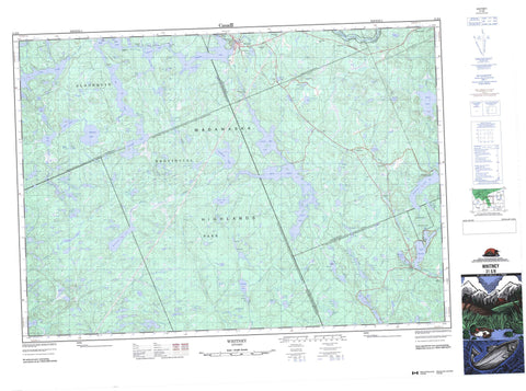
031E08 Whitney Canada topo map, 1:50,000 scale
031E08 Whitney NRCAN topographic map.
Includes UTM and GPS geographic coordinates (latitude and longitude). This 50k scale map is suitable for hiking, camping, and exploring, or you could frame it as a wall map.
Printed on-demand using high resolution, on heavy weight and acid free paper, or as an upgrade on a variety of synthetic materials.
Topos available on paper, Waterproof, Poly, or Tyvek. Usually shipping rolled, unless combined with other folded maps in one order.
- Product Number: NRCAN-031E08
- Parent Topo: TOPO-031E
- Map ID also known as: 031E08, 31E8, 31E08
- Unfolded Size: Approximately 26" high by 36" wide
- Weight (paper map): ca. 55 grams
- Map Type: POD NRCAN Topographic Map
- Map Scale: 1:50,000
- Geographical region: Ontario, Canada
Neighboring Maps:
All neighboring Canadian topo maps are available for sale online at 1:50,000 scale.
Purchase the smaller scale map covering this area: Topo-031E
Spatial coverage:
Topo map sheet 031E08 Whitney covers the following places:
- Card Bay - Echo Bay - Farm Bay - Forest Bay - Inlet Bay - Purcell Cove - Huckleberry Point - First Narrows - Red Pine Narrows - Airy - Bruton - Clyde - Eyre - Haliburton - Harburn - Hastings - Lawrence - Lyell - McClure - Murchison - Nightingale - Nipissing - Sabine - Wicklow - Jean Island - Tanner Island - Third Island - Amable Lakes - Aubrey Lake - Avery's Lake - Beanpole Lake - Big Mink Lake - Billings Lake - Boulter Lake - Camp Lake - Cauliflower Lake - Cecil Lake - Clyde Lake - Clydegale Lake - Coollas Lake - Copps Lake - Cranjelly Lake - Crossbar Lake - Crystal Lake - Drizzle Lake - Dry Lakes - East Galipo Lake - East Lake - Endomink Lake - Eyre Lake - Farm Bay Lake - Florence Lake - Flying Fisher Lake - Frank Lake - Frost Lake - Gale Lake - Galeairy Lake - Gem Lake - German Lake - Goulais Lake - Harder Lake - Harry Lake - Hay Lake - Lake Louisa - Lake St. Peter - Little Billings Lake - Little Boulter Lake - Little Branch Lake - Little Canoe Lake - Little Cauliflower Lake - Little Clear Lake - Little Galipo Lake - Little German Lake - Little Hay Lake - Little Longer Lake - Little Marguardt Lake - Little Marquardt Pond - Little Meach Lake - Lostwater Lake - Lower Dwyer Lake - Lower Hay Lake - Lower Perieau Lake - Luckasavitch Lake - Madawaska Lake - Marguardt Lake - Marquardt Pond - Martin Lake - Martin's Pond - McCoy Lake - McKenzie Lake - McNab Lake - Meach Lake - Meach Lakes - Mildred Lake - Moore Lake - Mudswamp Lake - Nates Lake - Nearline Lake - Night Lake - North Chainy Lake - North Galipo Lake - North Lake - Oxbend Lake - Pastwa Lake - Pat Lake - Pen Lake - Pinery Lake - Pondweed Lake - Poverty Lake - Princes Lake - Prottler Lake - Rainbow Lake - Rence Lake - Robinson Lake - Robison Lake - Rock Lake - Roundo Lake - Sandy Lake - Silver Lake - Silversheen Lake - Sitting Duck Lake - Skinny Lake - Skunkitten Lake - Soaking Lake - South Galipo Lake - South McGuire Lake - South Misty Lake - South Moccasin Lake - Stubby Lake - Sud Lake - Taylor Lake - Turf Lake - Upper Dwyer Lake - Upper Mink Lakes - Upper Perieau Lake - Upper Redstone Lake - Watson Lake - Welcome Lake - West Galipo Lake - White Lake - Yorkend Lake - Madawaska Highlands - Haliburton - Hastings - Airy - Algonquin Highlands - Bangor, Wicklow and McClure - Dysart, Dudley, Harcourt, Guilford, Harburn, Bruton, Havelock, Eyre and Clyde - Hastings Highlands - Herschel - Monteagle - Sherborne, McClintock and Livingstone - Sherborne, McClintock, Livingstone, Lawrence and Nightingale - Sherborne, Stanhope, McClintock, Livingstone, Lawrence and Nightingale - South Algonquin - Stanhope - Algonquin Provincial Park - Lake St. Peter Provincial Park - Upper Madawaska River Provincial Park - Amable Creek - Back Creek - Boulter Creek - Cauliflower Creek - Clyde Creek - Coghlan Creek - Crossbar Creek - Florence Creek - Fraser Creek - Galipo River - Green Creek - Hay Creek - Little Kennisis River - Louisa Creek - Madawaska River - Marguardt Creek - Marquardt Creek - Martin Creek - McCoy Creek - Meach Creek - Mink Creek - Moore Creek - North York River - Otter Creek - Papineau Creek - Pastwa Creek - Perieau Creek - Poverty Creek - Redstone River - South Madawaska River - Taylor Creek - York River - Airy - Gunters - Lake St. Peter - L'Amable - Madawaska - McConnell - McKenzie Lake - Princes Lake - Wallace - Whitney


