
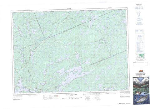
031E07 Kawagama Lake Canada topo map, 1:50,000 scale
031E07 Kawagama Lake NRCAN topographic map.
Includes UTM and GPS geographic coordinates (latitude and longitude). This 50k scale map is suitable for hiking, camping, and exploring, or you could frame it as a wall map.
Printed on-demand using high resolution, on heavy weight and acid free paper, or as an upgrade on a variety of synthetic materials.
Topos available on paper, Waterproof, Poly, or Tyvek. Usually shipping rolled, unless combined with other folded maps in one order.
- Product Number: NRCAN-031E07
- Parent Topo: TOPO-031E
- Map ID also known as: 031E07, 31E7, 31E07
- Unfolded Size: Approximately 26" high by 36" wide
- Weight (paper map): ca. 55 grams
- Map Type: POD NRCAN Topographic Map
- Map Scale: 1:50,000
- Geographical region: Ontario, Canada
Neighboring Maps:
All neighboring Canadian topo maps are available for sale online at 1:50,000 scale.
Purchase the smaller scale map covering this area: Topo-031E
Spatial coverage:
Topo map sheet 031E07 Kawagama Lake covers the following places:
- Archer Bay - Church Bay - Colonel's Bay - Crown Bay - Echo Bay - Emerald Bay - Fletcher Bay - Jean Bay - Loon Bay - Minden Bay - Parkside Bay - Rabbit Bay - River Bay - South Bay - Ten Mile Bay - Trading Bay - West Bay - White Trout Bay - Birch Point - Chevalier Point - Elizabeth Point - Ronville Point - The Narrows - Gravel Falls - Marsh Falls - Marshs Falls - Ragged Falls - Tea Falls - Upper Twin Falls - Whiskey Falls - Canisbay - Eyre - Finlayson - Franklin - Haliburton - Havelock - Lawrence - Livingstone - McClintock - Muskoka - Nipissing - Peck - Ridout - Sherborne - Sinclair - Aubrey Island - Bear Island - Big Trout Island - Clarke Island - Dennison Island - Eagle Island - East Long Island - Echo Island - Gent Island - Haserot Island - Janey Island - Little Trout Island - Long Island - Pancake Island - Raynor Island - Reuben Island - Rock Island - Trout Island - Turners Island - Tyrell Island - Wolf Island - Ahme Lake - Arbuckle Lake - Art Lake - Ashball Lake - Bear Lake - Beast Lake - Beetle Lake - Bena Lake - Bertie Lake - Big Hoover Lake - Big Porcupine Lake - Bivouac Lake - Blackwell Lake - Bloody Lake - Bluebell Lake - Bonnechere Lake - Bright Lake - Brooks Lake - Buchanan Lake - Buck Lake - Burns Lake - Camp Lake - Campcot Lake - Charcoal Lake - Claude Lake - Clayton Lake - Clean Lake - Clinto Lake - Cod Lake - Coot Lake - Corbett Lake - Cotter Lake - Cradle Lake - Cross Corner Lake - Crotch Lake - Crown Lake - Crumby Lake - Crystalline Lake - Dagger Lake - Dale Lake - Depot Lake - Dividing Lake - Docker Lake - Dot Lake - Dotty Lake - Doughnut Lake - Duplicate Lakes - East Jeannie Lakes - Eighteen Mile Lake - Eiler Lake - Ermine Lake - Eyre Lake - Feline Lake - Fen Lake - Fifteen Mile Lake - Fisher Lake - Fitzell Lake - Fletcher Lake - Flossie Lake - Founders Lake - Frog Lake - Goodwin Lake - Gosling Lake - Greenwood Lake - Guskewau Lake - Hardup Lake - Hare Lake - Harness Lake - Harvey Lake - Havelock Lake - Helve Lake - Heron Lake - Hickory Lake - Hilly Lake - Hinterland Lake - Hobo Lake - Hosiery Lake - Ingrams Lake - Jeannie Lake - Johnson Lake - Kawagama Lake - Kelly Lake - Kimball Lake - Kingfisher Lake - Kirkwood Lake - Lake Louisa - Lake of Bays - Lawrence Lake - Leach Lake - Lemon Lake - Limburner Lake - Ling Lake - Little Buckhorn Lake - Little Coon Lake - Little Dotty Lake - Little Hardy Lake - Little Hoover Lake - Little Kennisis Lake - Little Louie Lake - Little Mohawk Lake - Little Nelson Lake - Little Oxbow Lake - Little Rookery Lake - Little Smoke Lake - Little Spaniel Lake - Little Troutspawn Lake - Livingstone Lake - Loader Lake - Longline Lake - Loon Lake - Louie Lake - Lower Fletcher Lake - Luck Lake - Lucy Lake - Lumber Lake - Maggie Lake - Maple Leaf Lake - Martencamp Lake - McCann Lake - McFadden Lake - McGarvey Lake - Merdie Lake - Middle Pond - Midget Lake - Mikado Lake - Millichamp Lake - Minkey Lake - Minnow Lake - Minto Lake - Miry Lake - Mohawk Lake - Mooney Lake - Nelson Lake - Niger Lake - Norman Lake - North Dotty Lake - North Grace Lake - North Havelock Lake - North Lemon Lake - Notsobig Lake - Otter Lake - Oxbow Lake - Oxtongue Lake - Paddy Lake - Pardee Lake - Park Lake - Phipps Lake - Pinfeather Lake - Pipio Lake - Plough Lake - Poorhouse Lake - Porridge Lake - Powderhorn Lake - Pup Lake - Quiver Lake - Ragged Lake - Roadline Lake - Rockaway Lake - Rod and Gun Lake - Roger Lake - Rookery Lake - Samlet Lake - Scott Lake - Seventeen Mile Lake - Shawandasee Lake - Shier Lake - Sixteen Mile Lake - Skunk Lake - Slim Lake - Slipper Lake - Sly Lake - Small Lake - Smoke Lake - Snap Lake - Snow Lake - South Nelson Lake - South Tasso Lake - South Tea Lake - South Wildcat Lake - Spaniel Lake - Split Rock Lake - Steeple Lake - Steeprise Lake - Stocking Lake - Stringer Lake - Sunken Lake - Sunrise Lake - Swan Lake - Sward Lake - Tasso Lake - Tea Lake - Teardrop Lake - Thinbeaver Lake - Thumb Lake - Toad Lake - Tock Lake - Troutspawn Lake - Upper Head Lake - Upper Oxbow Lake - Victory Lake - Wells Lake - West Frog Lake - Westward Lake - Whatnot Lakes - White Lake - Wilbur Lake - Wildcat Lake - Wilson Lake - Wisp Lake - Wolf Lake - Wolfish Lake - Wolfsbane Lake - Ball Mountain - Manitou Mountain - Haliburton - Muskoka - Algonquin Highlands - Dysart, Dudley, Harcourt, Guilford, Harburn, Bruton, Havelock, Eyre and Clyde - Franklin - Lake of Bays - McLean - Ridout - Sherborne, McClintock and Livingstone - Sherborne, McClintock, Livingstone, Lawrence and Nightingale - Sherborne, Stanhope, McClintock, Livingstone, Lawrence and Nightingale - Stanhope - Algonquin Provincial Park - Big East River Provincial Park - Dividing Lake Provincial Nature Reserve - Dividing Lake Provincial Park - Oxtongue River-Ragged Falls Provincial Park - Little Twin Falls - Whiskey Rapids - Ahme Creek - Big East River - Black River - Bravender Creek - Bright Creek - Buchanan Creek - Buckhorn Creek - Butter Ball Creek - Clinto Creek - Cod Creek - Crown Creek - East River - Ermine Creek - Eyre Creek - Fletcher Creek - Gateway Creek - Guskewau Creek - Hardy Creek - Head Creek - Hinterland Creek - Hollow River - Hoover Creek - Kenneth Creek - Kennisis River - Kimball Creek - Little Kennisis River - Little Oxbow Creek - Livingstone Creek - Louisa Creek - Maggie Creek - Maple Leaf Creek - Marion Creek - Merdie Creek - Midget Creek - Mohawk Creek - North Lemon Creek - Oxbow Creek - Oxtongue River - Parkside Creek - Pipio Creek - Quiver Creek - Rebecca Creek - Rookery Creek - Sixteen Mile Creek - Slipper Creek - Smoke Creek - South Nelson Creek - Spaniel Creek - Swan Creek - Tasso Creek - Tea Creek - Ten Mile Creek - Thumb Creek - Toad Creek - Troutspawn Creek - Wildcat Creek - Raynor Shoal - Turners Rock - Antioch - Birkendale - Fox Point - Limberlost Lodge - Oxtongue Lake - Russell Landing - Sea Breeze - Reservoir Marsh


